
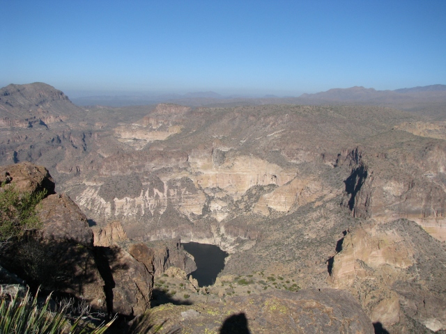
Friday (Pearl Harbor Day) the club hiked what we’ve called the “Apache Lake Overlook” route. The hike actually takes you to the top of Black Cross Butte high above the Horse Mesa dam complex on the Salt River. Apache Lake isn’t visible, or maybe I overlooked it (pun intended). A small patch of Canyon Lake is visible a few miles westward from the mesa edge. (Bottom center of the photo below)
But I’m getting ahead of myself here.
This hike starts from an ad hoc trailhead at the security gate at the top of the road down to Horse Mesa dam. On the north side of the road, a faint trail starts you on a northwesterly leg along the base of some rugged buttes. Total distance (in and out on the same route) is just over 3.5 miles. Total ascent is on the order of 1,100 feet. This is not an “official” trail, sees no maintenance; footing can be kind of gnarly in spots, and there is a fair amount of exposure steep (not sheer) dropoffs. Wear strong shoes, carry a staff, and mind your footing (especially on the downhill return). But go. It’s a great hike.
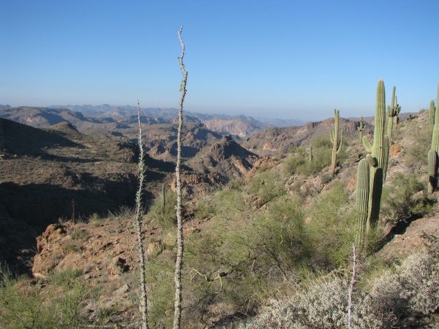
As you head out, the scenery becomes quickly rugged and beautiful. You’re already at pretty decent elevation, so the views are “horizon to horizon”. The peaks of the western Superstitions lie to the south and west. In the scene below, Flatiron is seen at the horizon, perhaps 15-18 miles away.

The trail works it’s way steadily up the butte faces, and your sight lines shift in a more westerly direction over the canyonlands of the Salt river, and eventually northerly towards Four Peaks in the Mazatzal wilderness.
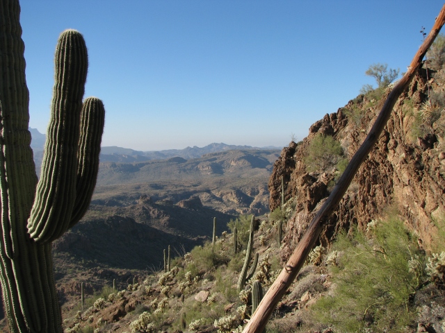

The scene below was shot from the top of the mesa. Four Peaks is at the center horizon, the mid-distance cliffs are north of the Salt River, and off my left elbow you can see the settlement where the staff of the Horse Mesa dam lives. Those homes are more than 2,000 feet lower in elevation, and a couple of miles away. As you can see by my perspiration-soaked cap, this was a strenuous climb on a coolish day (temp mid 60’s at this elevation of about 3,200 feet).

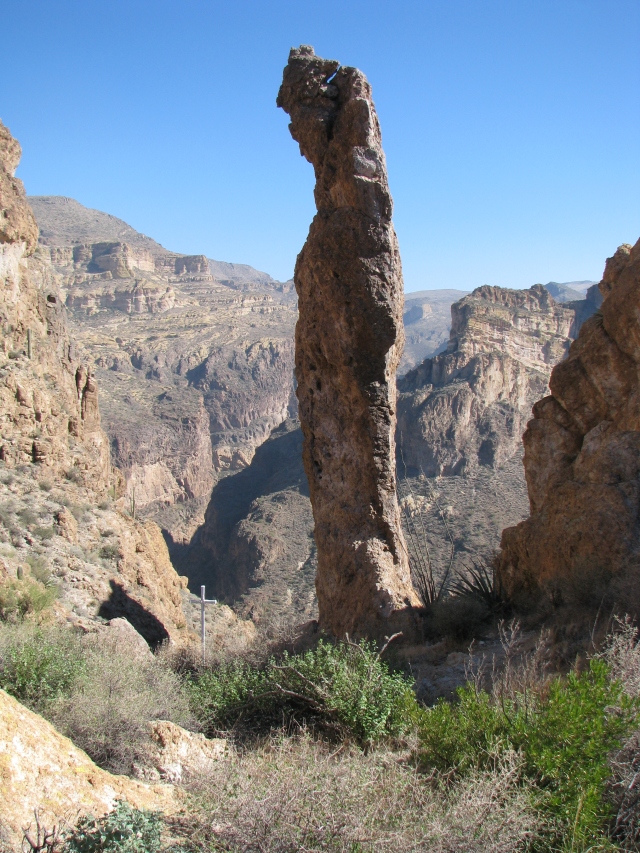
Occasionally in the back country you find reminders of the dangers of this canyon wilderness environment. In the photo below, note the small white cross just to the left of the rock spire. Someone perished here, and is memorialized by this obscure wilderness monument.
Just beyond the spire is a shear drop of hundreds of feet. Did someone venture too close to the edge? Or foolishly try to climb the tall rock finger? The cross is silent.
Nearby, less than 20 feet from where I stood to take this photo, is evidence that even nature took the time to note the passing of the adventurer who died here. This small staghorn cholla cactus, perhaps a foot tall, overlooks the same scene. The plant is so perfect it looks “made up”, but I examined it, and it is natural growth. Never saw one like this ever before.
RIP, traveler.


It’s the most beautiful photos that we never seen. Thank you for the sharing. With love, Nicole and Eugene
LikeLike
Thanks—the natural cactus cross is simply amazing and so near the human made cross as well!
LikeLike
The cactus cross makes a person give 2nd thoughts on Mother Nature.
LikeLike
Great photos, especially the one with you in it.!
LikeLike