Wednesday the group did three hikes. A few (nut cases) headed south to the challenge of climbing Picacho Peak, and the rest of us headed up the Apache Trail past Tortilla Flat to Forest Route 80 and the “trailhead” above Horse Mesa Dam.
There we did a bifurcated hike, with half the group hiking down into Fish Creek Canyon (“Grand Canyon of the Superstitions” — see my blog from January of 2012) and the rest of us heading uphill to the top of Black Cross butte.
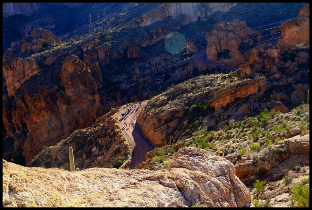
“You take the low road and I’ll take the high road” — below you see the canyon group heading down FR80 which will take them about 2.5 miles and 900 feet down to their turnaround spot.
Our route will be uphill, about 1.5 miles with about 1100 feet of elevation gain over the route. Our destination is the top of the butte seen at top center in the photo below, and the trail will NOT be a smooth one! Basically the route takes us to the bottom of the cliff in the foreground, then left and “off screen” and up and around on a path with some “edgy” segments with “ball bearing” footing that would have turned me around for home a few years back. Slow and easy does it!
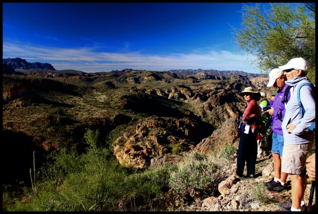
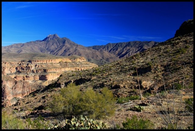
But the views are worth it! Soon you gain some altitude above the surroundings, and long horizons over the wilderness are the order of the day. The formation at the left horizon is the Flatiron, I’d guess about 15 miles distant.
Here are some more views seen on the ascent.
From time to time on these hikes we come across curious sights which cause you to scratch your noggin and try to imagine “what is this about?”. Here, shortly after we reached the flat top of the butte, we came upon the scene below. This circle is about 8-10 feet in diameter, and someone(s) spent a lot of energy in this remote spot to “make their mark”.
Note: After publishing this hike, my “Lil Sis” Carolyn suggested that this circle might be a Native American medicine wheel. After googling up some images, I’m certain that she’s right. Thanks!
Before heading back down we wandered around the rim of the plateau admiring the views.
In the scene below the foreground is Fish Creek Canyon at the point that it enters the Salt River Canyon. This is where our “downhill hike” companions will lunch and turn back to the cars.
Upstream on the Salt (out of view towards middle right of the photo) is Horse Mesa Dam which forms Apache Lake. Lower center of the photo you can see a cluster of homes for the workers who take care of the dam. It’s a long drive over twisty cliffside roads to the corner store for a loaf of bread!
Here are some more views from our lofty lunch perch down into the surrounding wilderness.


Great photos, as expected 🙂
LikeLike
Nice pictures Hans. No shots of the base jumpers though?
LikeLike
Thank you Hans for sharing. The circle of rocks could be a clue to the lost Dutchman. (just kidding)
LikeLike
You may be on to something, Norm!
🌵Sent from Arizona 🌞
On Sat, Feb 1, 2014 at 10:46 AM, Wandering About With No Supervisi
LikeLike