
 North of the Superstitions lies another range of mountains, called the Mazatzals. The Superstitions seem to get all the attention and publicity, perhaps because of their “mysterious” name and the legend of the Lost Dutchman Gold, but for size, diversity, and beauty the Mazatzals win my vote. The southmost end of the Mazatazals is Four Peaks, pictured above. Is it 4 mountains, or 1 mountain with 4 peaks? Beats me, but it’s an impressive place!
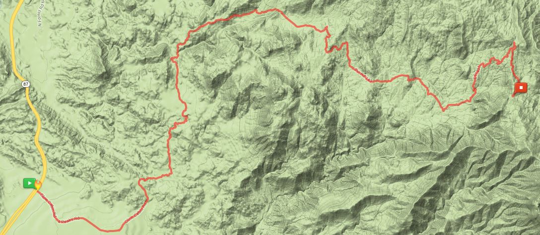
On Friday ten CVHC hikers tackled the trail to Browns Peak. It is the tallest of the 4, reaching an altitude of 7,657 feet, and is the leftmost peak in the picture above (in the photo it might appear shorter, but it is set back, so is shortened in perspective). From a distance it is impossible to visually imagine how to approach this mountain, and getting to the trailhead was an adventure in itself. Leaving highway AZ87 on Cline Cabin Road, we traveled 20 miles on a very rough slow route climbing almost 4,400 feet to the Lone Pine Trailhead. Average speed was perhaps 8MPH, as it took somewhat over 2 hours to negotiate. High clearance vehicles are a MUST for this road.
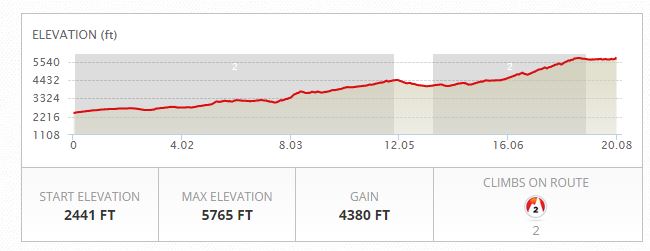 The trailhead lies in the notch to the north (left) of Browns Peak. Nice trailhead with room for 20 or more vehicles. Browns Peak is about a 3 mile hike from here.

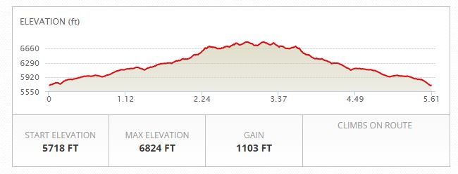
We didn’t hike to the very tippy-top of the mountain, a very forbidding place as seen in the shot below, but to a saddle about 800 feet below the summit. This photo is taken from that saddle, and the trail actually DOES continue to the summit but borders on mountaineering, not hiking.
 I’d classify this hike as a moderate physical effort. It’s not very long, and the accumulated elevation gain is only 1,100 feet, so it would seem easy, but the starting point is well over a mile above sea level and goes up from there. To this Minnesota flat-lander, the thin air made my legs noticeably slower! On the plus side, the altitude also meant cooler temperatures, in the mid-40’s, a blessing when working hard to reach that next flat spot in the trail ahead.
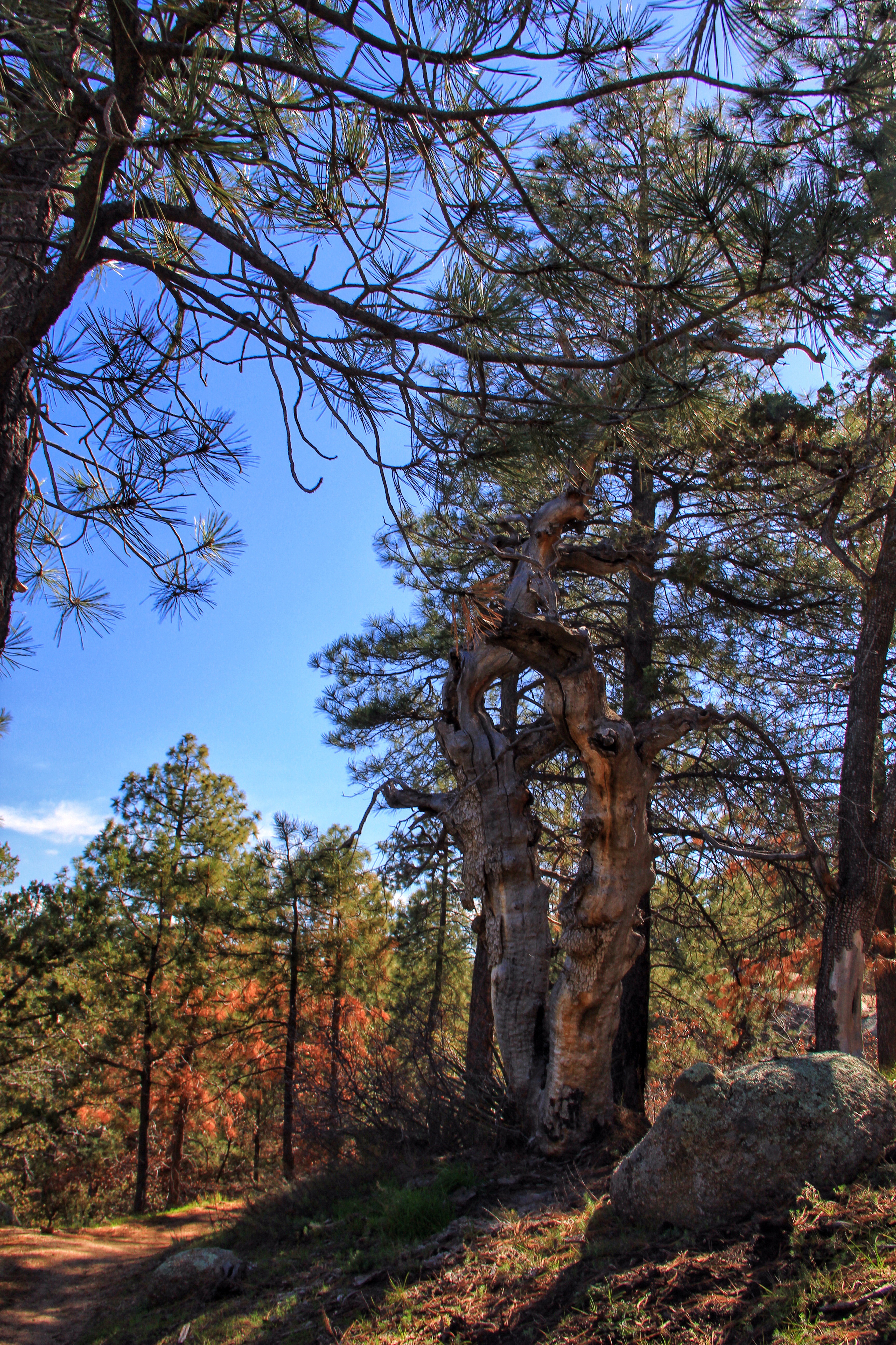
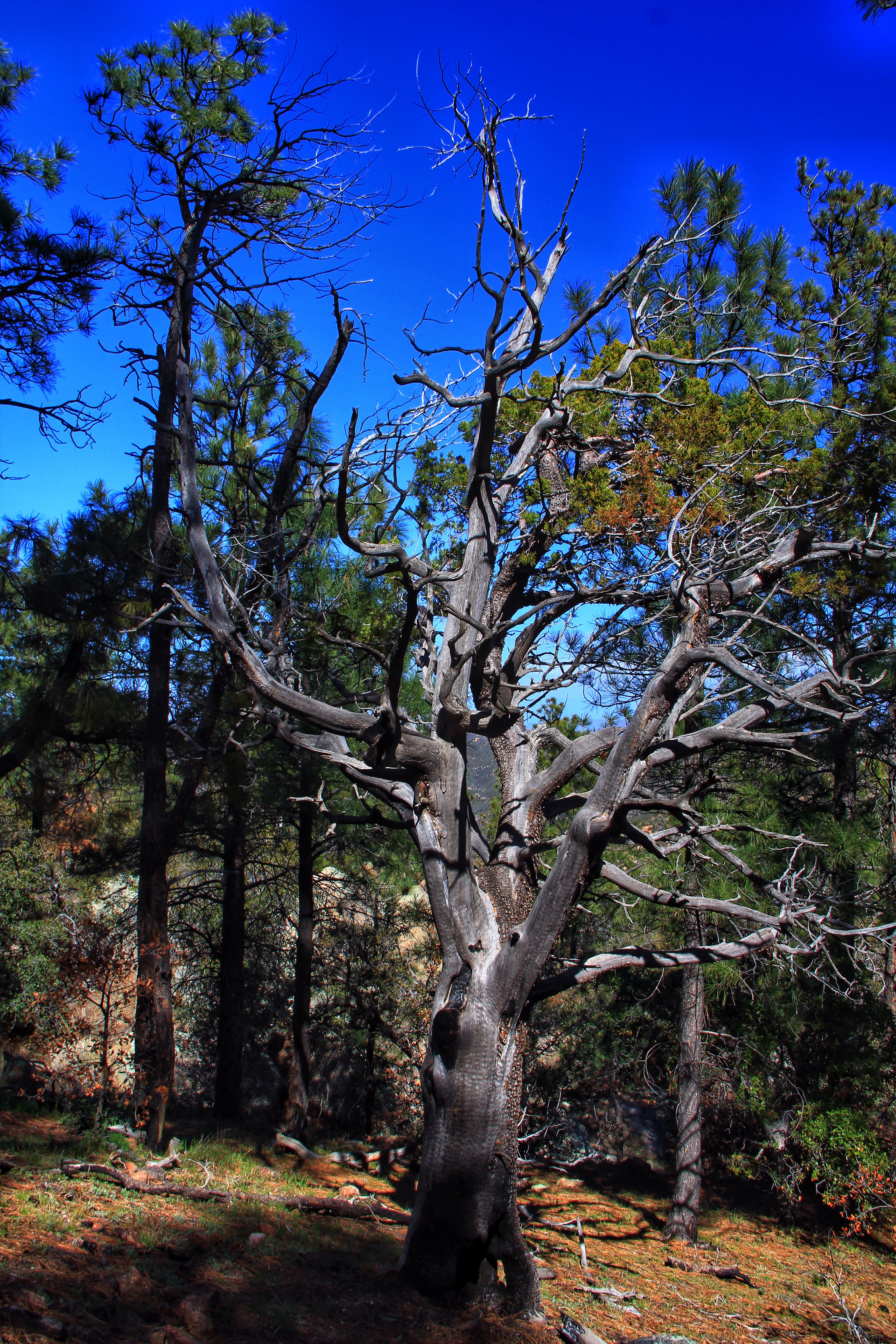
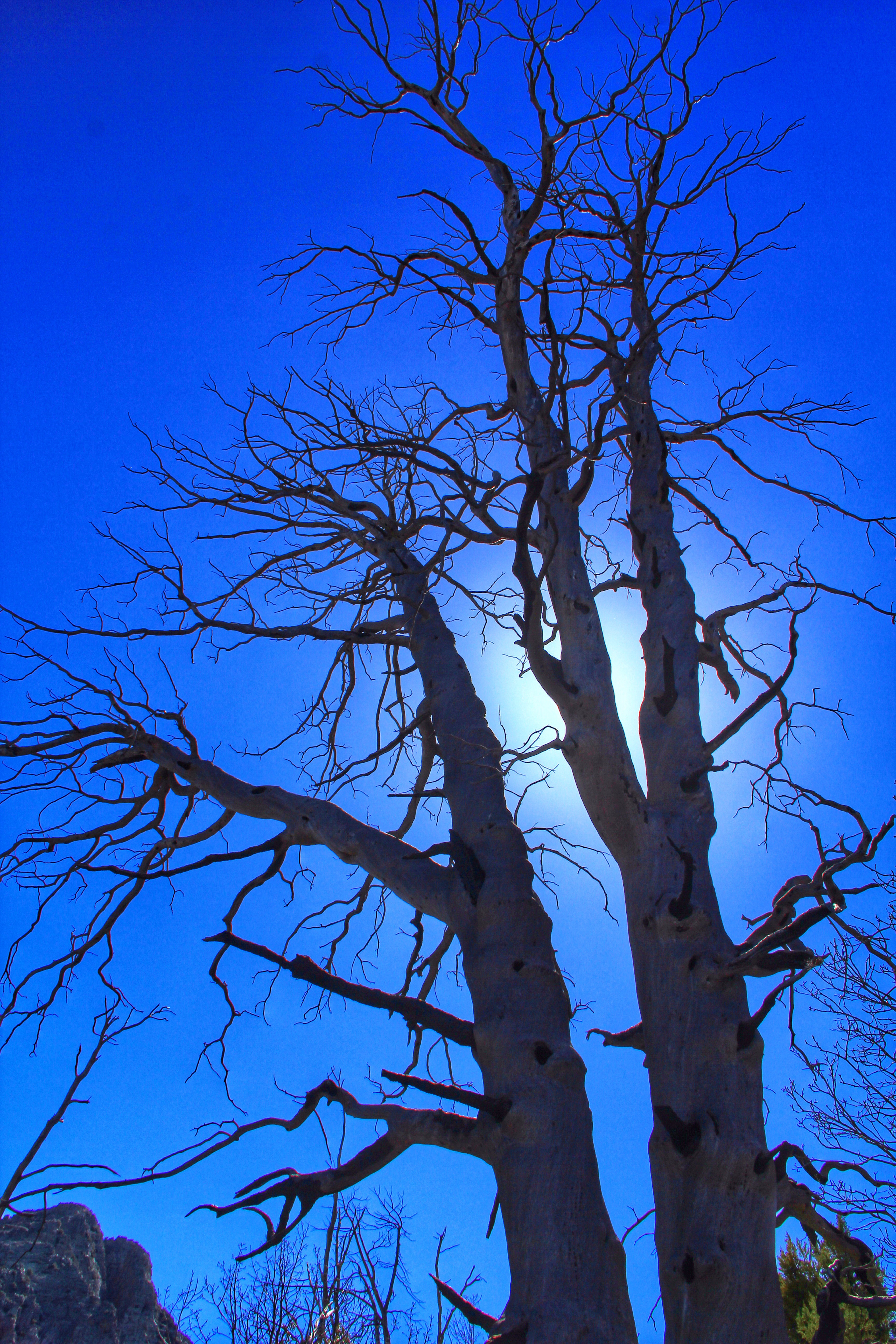
The early going in the hike is in a fire-damaged forest of Ponderosa pines. A fire (human caused) occurred here in 1996, and mother nature works slow at this altitude, so a lot of the damage is still very evident. Even so, the scenery is gorgeous and the trail tread is good, so “walking and gawking” is the order of the day.

At one point we noted this curious white powder substance along the trail (see below). One hiker recalled that she had made men out of larger quantities of this substance when she was a child in the Dakotah Territory. Odd story, don’t you think? We passed on by, as the substance seemed harmless. One hiker put a sample in his backpack to examine back in camp, but when we got back to the trailhead it had somehow escaped from the backpack, even though it was tightly zippered shut.

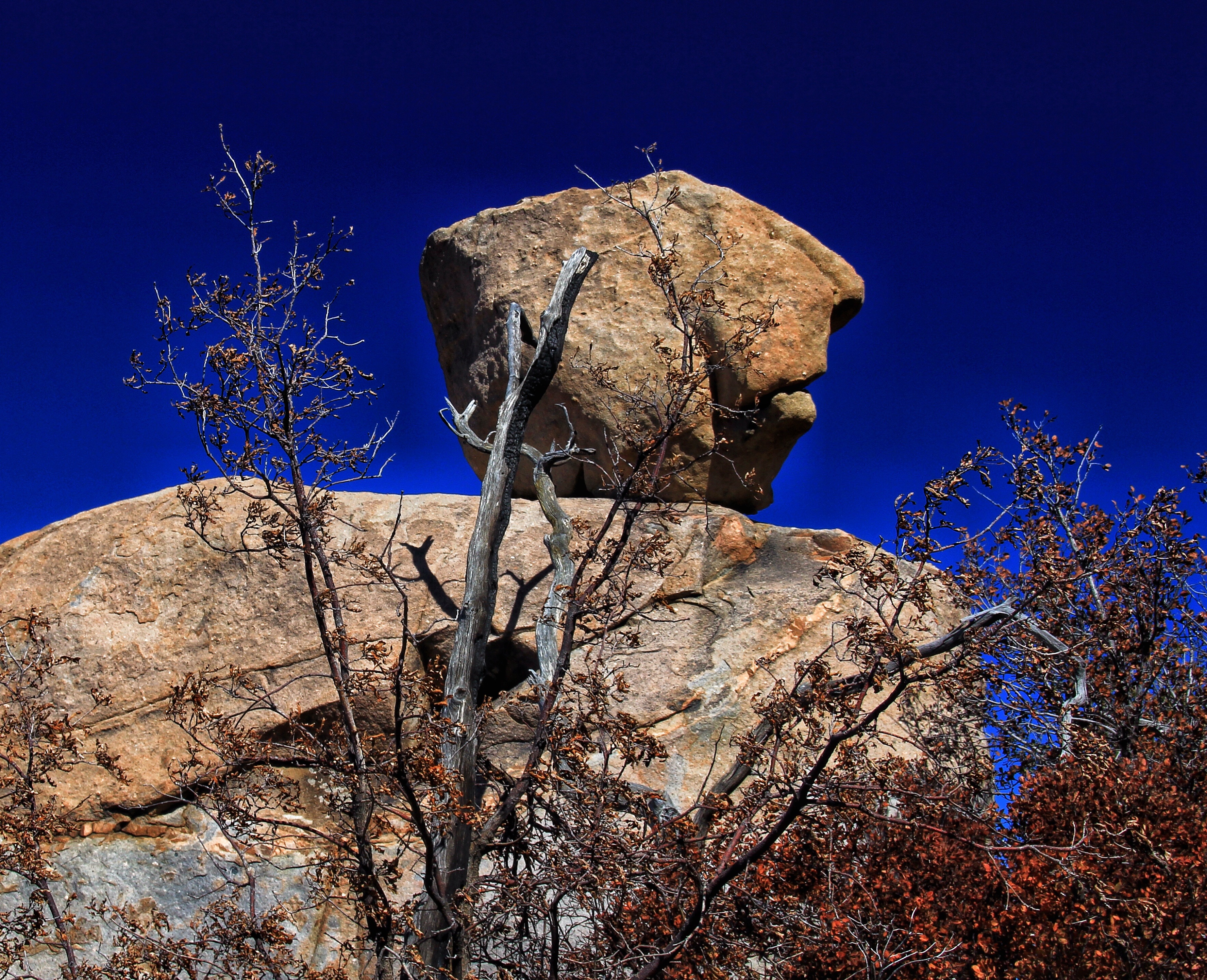
This stone “head” was a popular “stop and take a picture” attraction.
 As we gained altitude the pines disappeared and were replaced by smaller junipers, manzanita, and other shrubs.
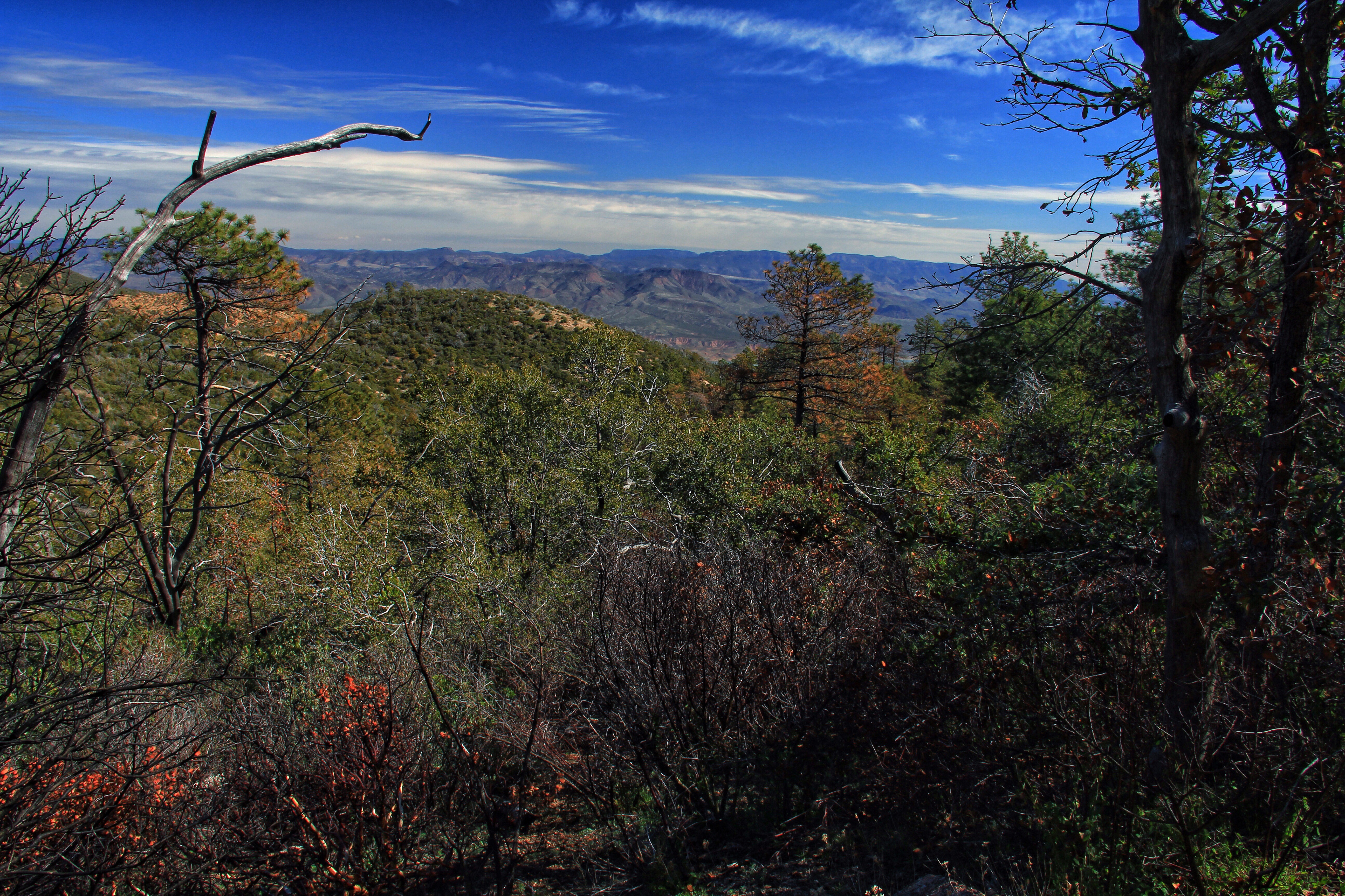
As mentioned earlier, the turn-around point for our hike was a saddle just below the peak. Here the views were stupendous!
 The scene above is the view looking southwestward from our lunch spot. The formation at the top center is our familiar Flatiron and to the left of it, “Peak 5057”. From our vantage almost 2,000 feet above them, their usual grandeur fades a bit.
 In this scene, looking northwesterly, the San Francisco Peaks at Flagstaff are visible on the horizon, just left of the dead tree.

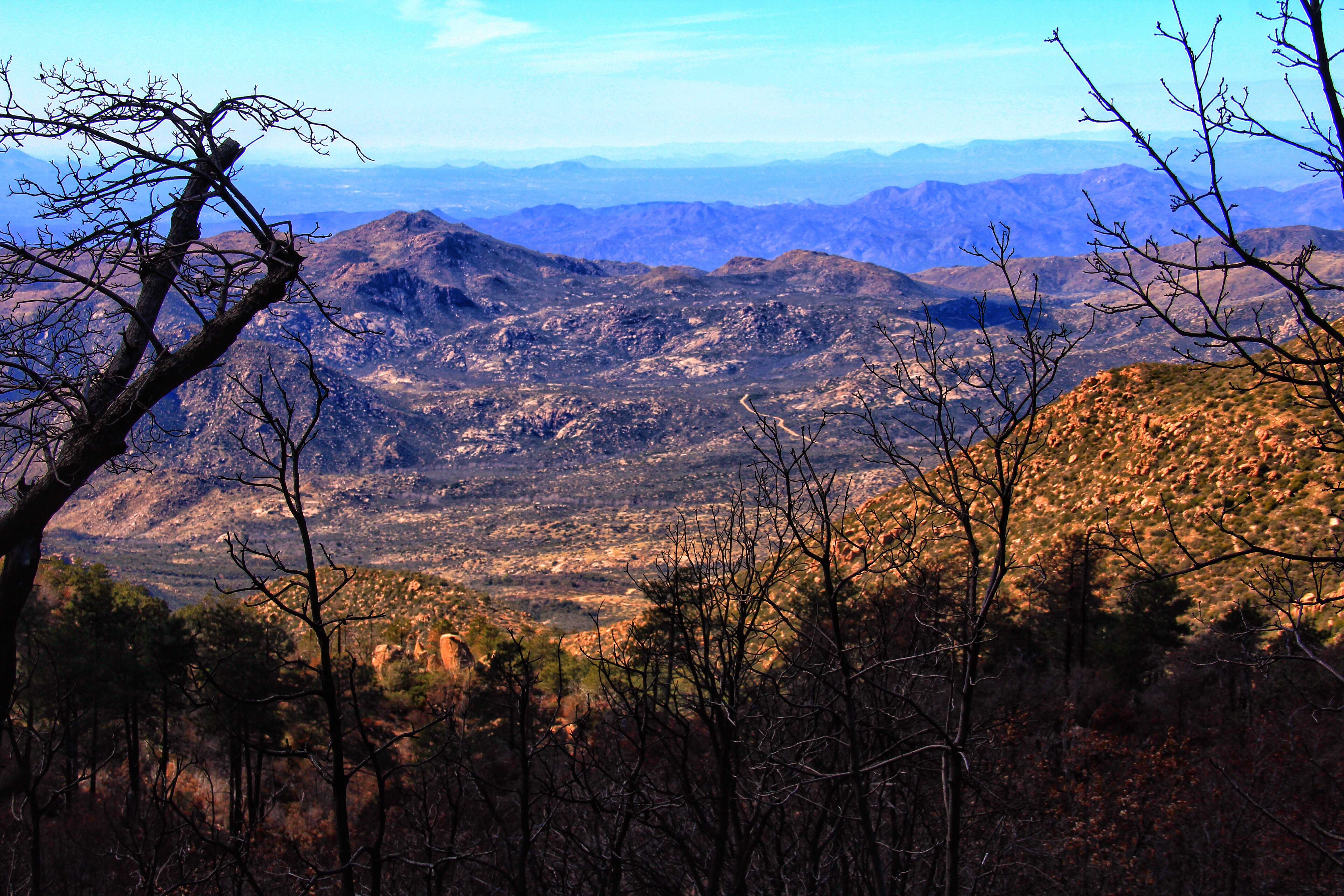
Looking to the east (above) into the Tonto Basin, Lake Roosevelt is seen at mid distance. To get some “scale”, the near shoreline of the lake is about 15 miles away. Just beyond the lake lie the Sierra Ancha mountains, and at the horizon are the White Mountains up at Show Low and Pine Top.
Below is a view looking westward. A portion of our road is at center-scene.
 After our lunch/photo break we left the saddle with the thought of “wouldn’t this be a great spot to photograph the sunset and a following sunrise” as we ambled back downhill to the trailhead.
Our trip back down the mountain was by a less harrowing route. Turns out that there is a shorter (10 mile vs. 20 mile) route down the eastern side of the mountain to AZ188 north of Tonto. It is much steeper, but in amazingly good shape. A road grader had recently maintained it, and you could drive it a low-slung sports car. I imagined driving driving it in my (long gone) ’62 Corvair Monza 900! We were down the mountain in less than a half hour. Even though it added another 40 miles or so on the blacktop, it was still much faster than our inbound route.
Yes, I recommend this hike highly, especially on a hot day (take the eastern road up to the trailhead).

Nice photos, wish I could’ve been with you on that hike
LikeLike
Great Shots, Hans.
LikeLike
I wish I could have been there, too! Wonderful photos!
LikeLike
Wonderful pictures and description! I hope the club puts this hike on the list to do each year.
LikeLike