
I love it!
Because the Boulder Canyon Trail from the marina to the Battleship Overlook is perhaps the shortest route available to see the rugged grandeur of the interior of the Superstition Mountains.
But I hate it!
Because the hike starts with an immediate leg burning climb up a non-descript hill ridden with false crests and blessed with no shade at all. It’s a tough climb, but the rewards ahead are great, so just “do it”!

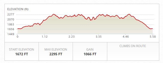
Overall the hike was about 5.5 miles with under 1,100 feet of accumulated elevation gain.
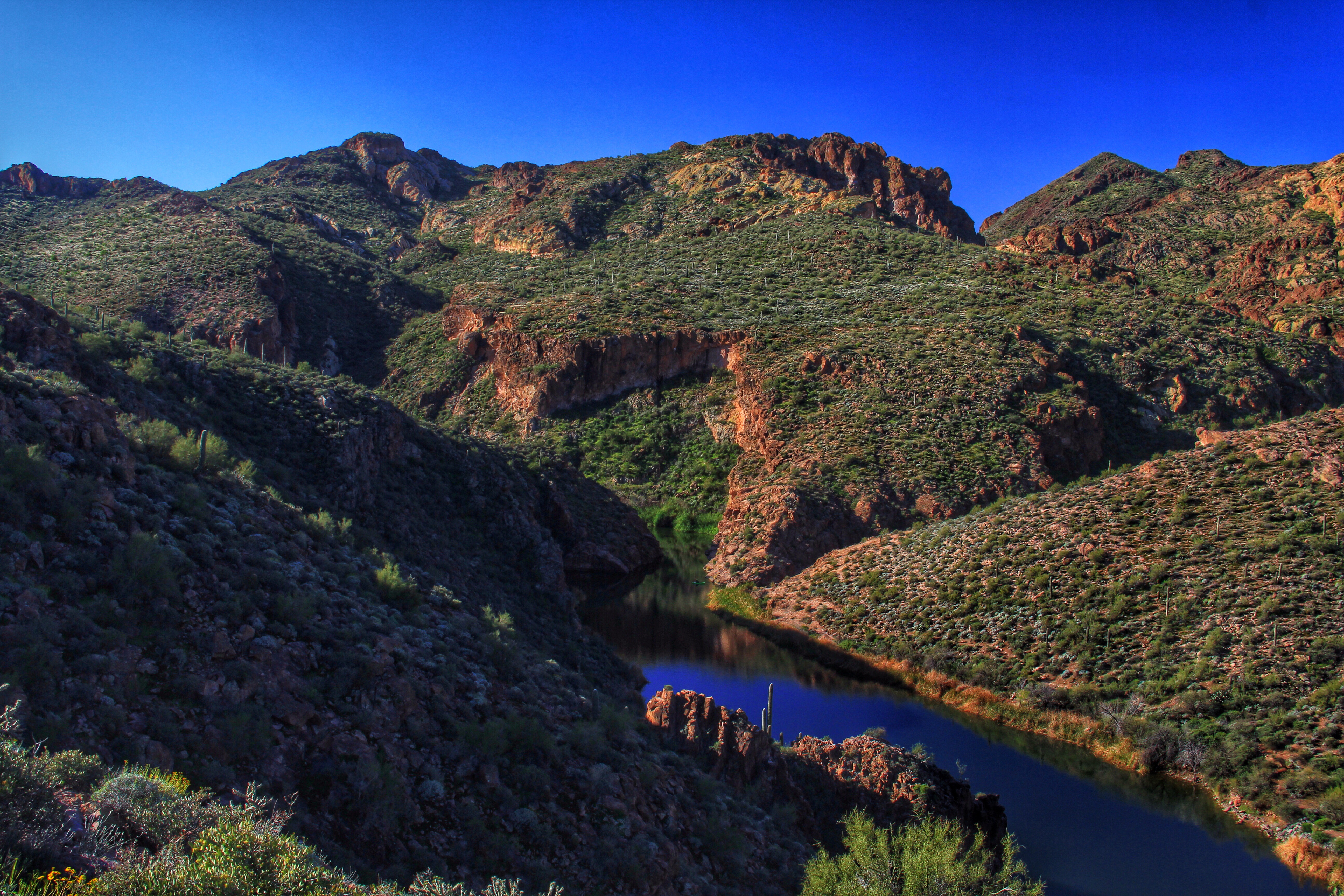
Leaving the trailhead you get some nice views of Canyon Lake and a flooded portion of LaBarge Creek near the lake.

Once you gain the top of that pesky hill the route becomes an easy hike over rolling terrain with great views in all directions.
This view to the north shows a volcanic eruption of the Four Peaks. Well, actually not, but the first glance gave a pretty good imitation!

Here’s a wider view to the east. The road at the right of the scene goes around a corner and then down to Tortilla Flats. Beyond that, the picturesque drive out to Roosevelt Dam.
 Toward the southwest is the familiar profile of Flatiron.
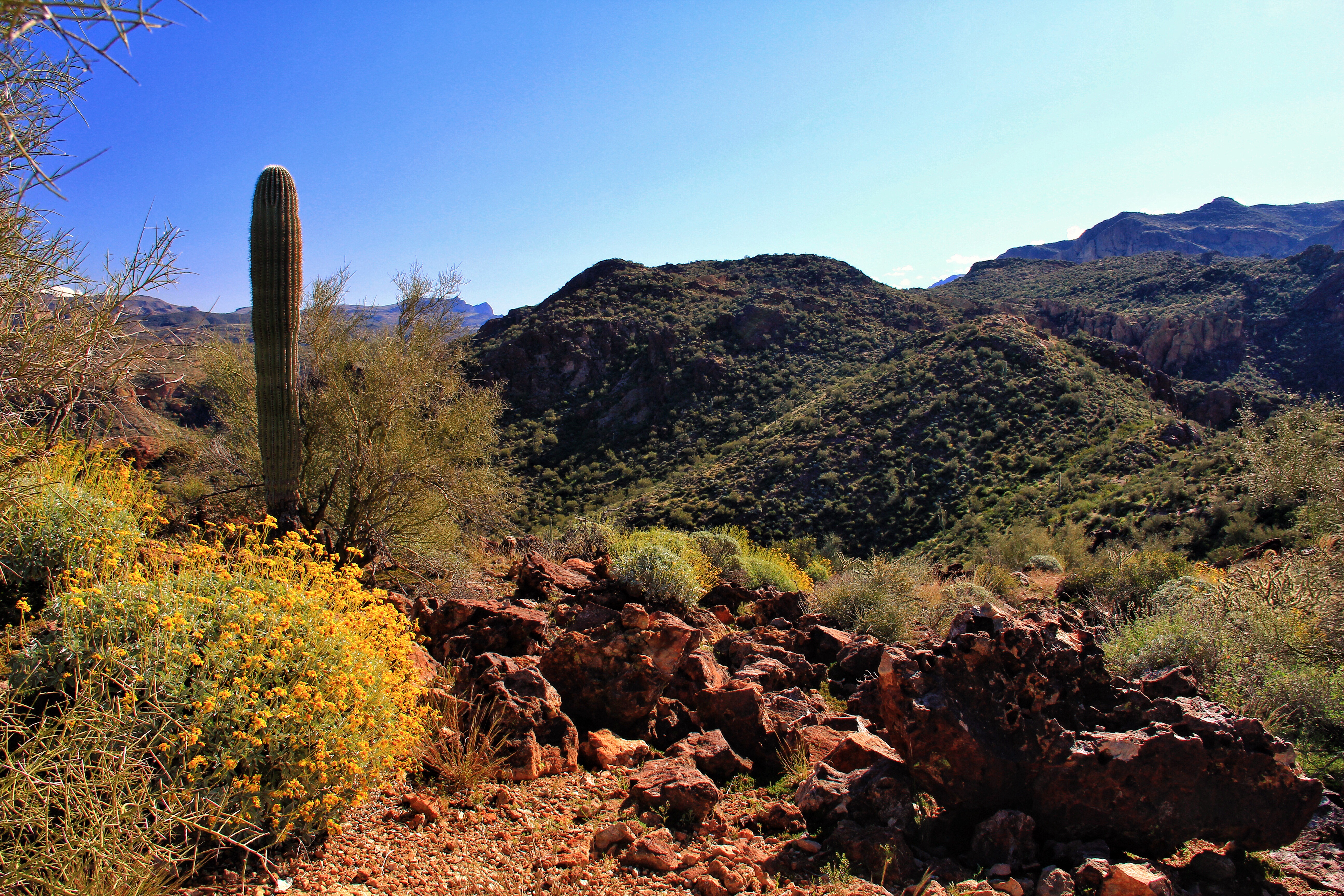
And to the south our first peek into the interior.
Brittlebush flowers were everywhere along the trail. The few earlier dismal rainy days are paying off in great promise of color this spring.
Somehow an agave plant in the foreground lends depth and class to a photo, don’t you think?
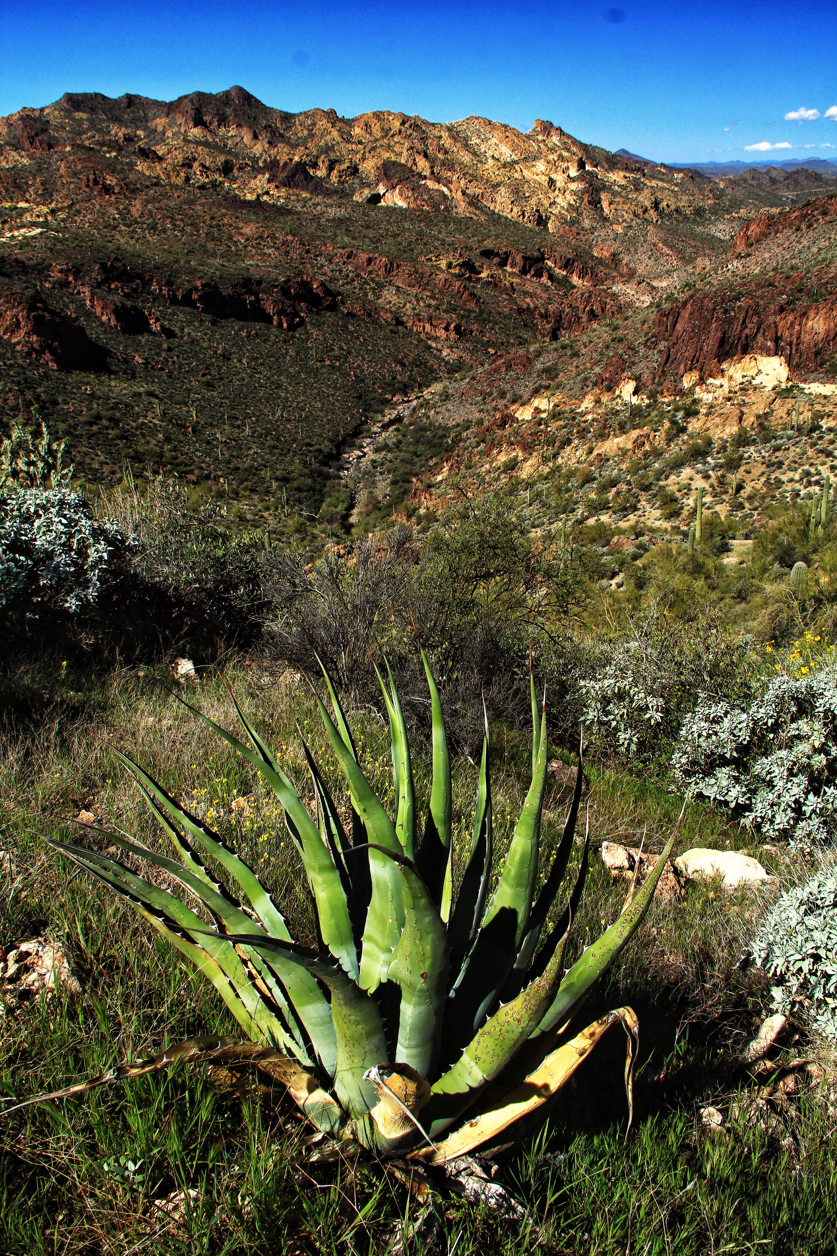
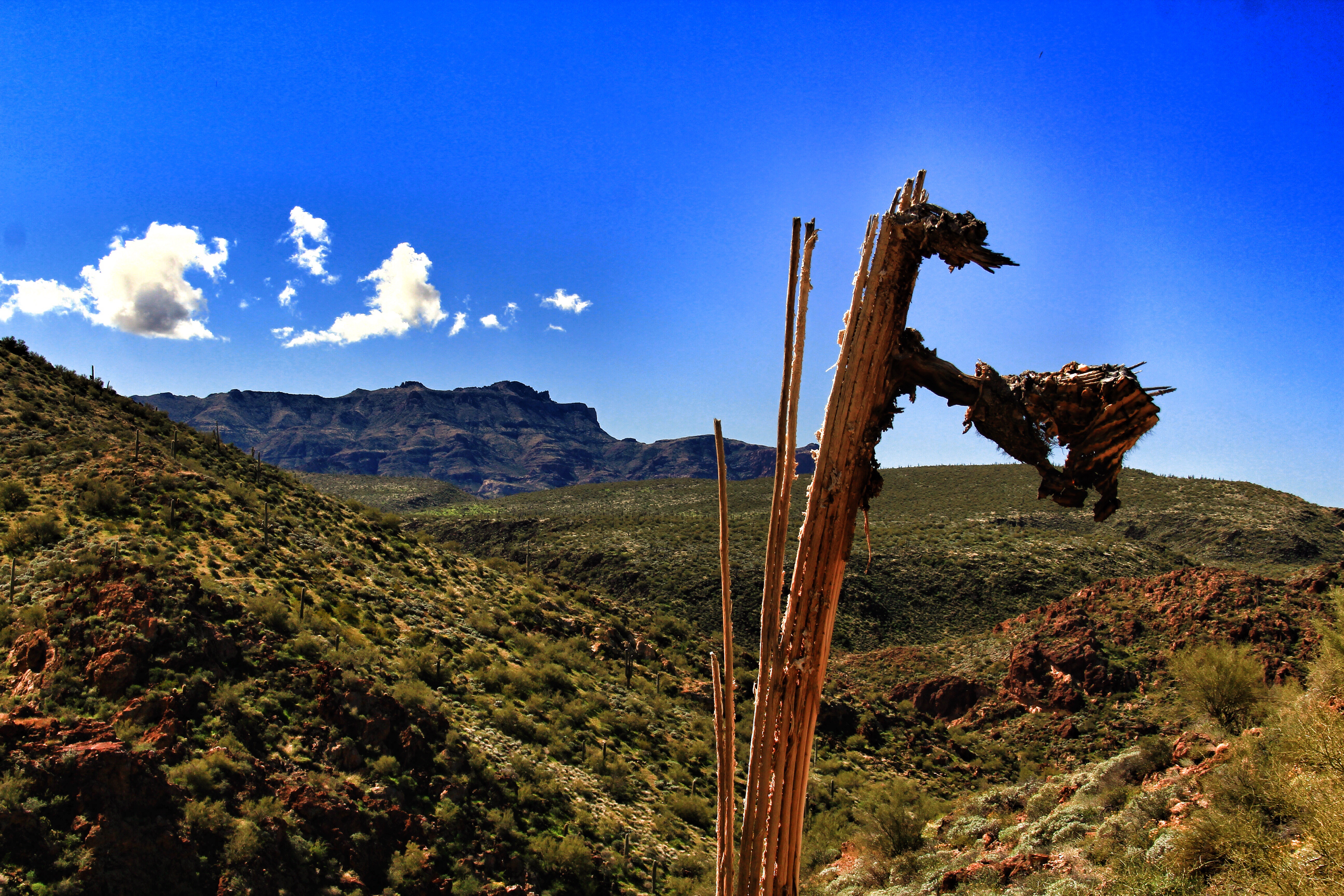
Another view to the south, a little further along the trail.

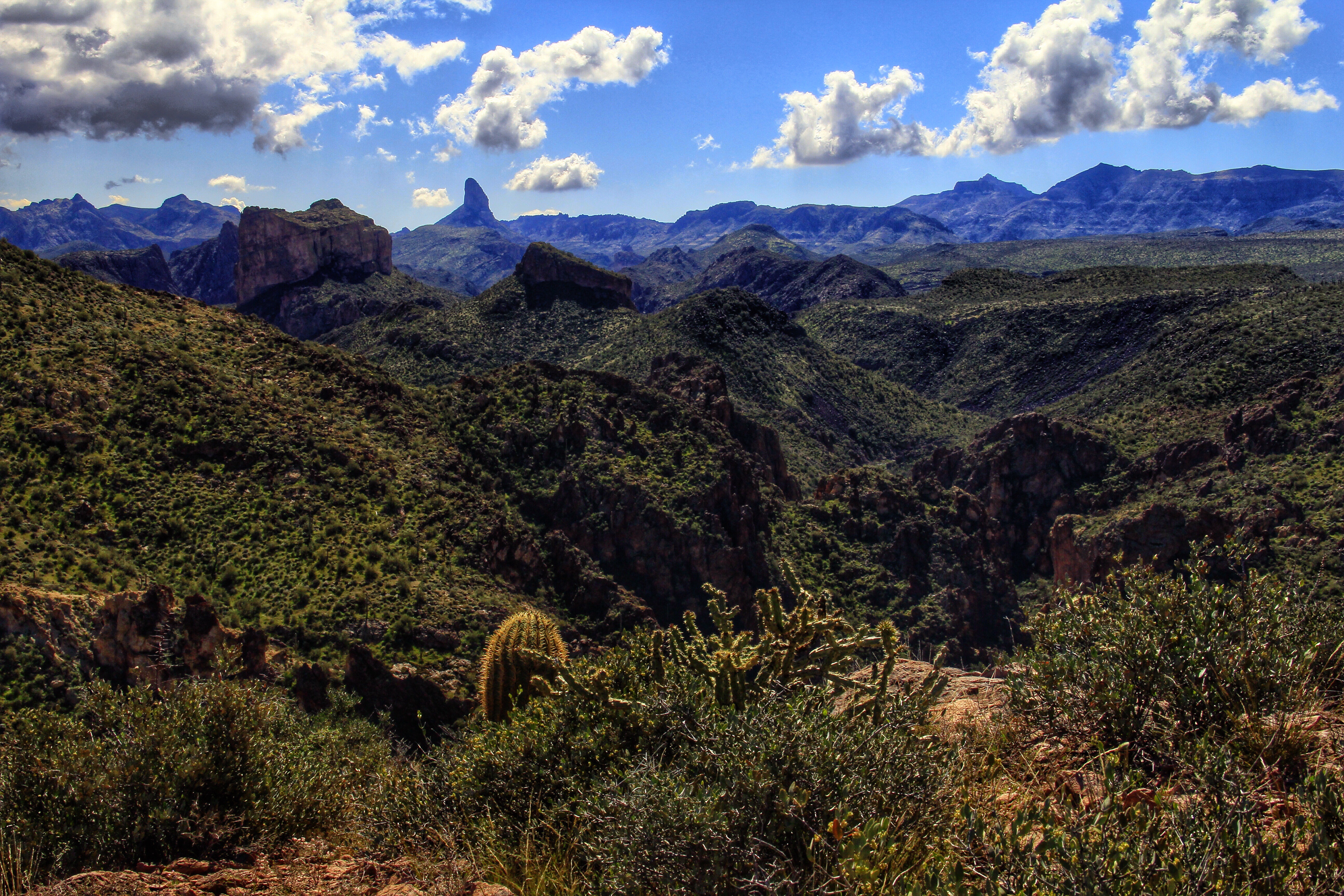
Our turnaround point/lunch-stop on this hike is a high cliff-edge vantage, about 900 feet above Boulder Canyon. The view is breath-taking, no matter how many times I come here. (See below)
The (dry) streambed below is LaBarge Creek. At scene-center, the formation with the severe cliffs is Battleship Mountain, here seen looking at the port bow. It looks much more like a ship when seen in side profile. Peeking around the stern is Weavers Needle.

It really is a great place to rest your legs and take in the view.
As an aside, in this scene the “tame looking” area across the canyon is the vicinity of Garden Valley which we traverse on some hikes out of First Water trailhead. A small contingent of our crew were dropped off at First Water and hiked across from there. They joined us at this overlook and hiked out with us back to the Canyon Lake trailhead. I was tempted to join them, but the 900-foot climb out of the canyon was a dis-incentive. In retrospect, that’s only 300 feet more than the slog up in that “I hate it” whine at the start of this post.
Next time!

Did you ever wonder how Katie always seems to finish hikes so far ahead of most of the rest of us? She just hangs on tight and tells this guy that there’s a treat back at the car!

After lunch, we retraced our track back to the lake. A few of us took a shortcut down a steeper track from the early hilltop, cutting perhaps a half mile off the return. You can see the difference in the track and elevation charts at the top of this post. Good way to come back, but I wouldn’t relish climbing out over that track.


Beautiful pics, as usual!
LikeLike
Your pictures and descriptions are wonderful! I look forward to reading them after each hike. Thank you!
LikeLike
Beautiful photos Hans. Thank you for sharing.
LikeLike
That’s a nice picture of Jazmin, Hans, but you know why she’s on that leash during our lunch, don’t you? 🙂
LikeLike
If she wasn’t on a leash, we wouldn’t have any lunch left?
LikeLike
Your survival skills appear to be intact. 😉
LikeLike