Martinez Canyon — In Silver Country


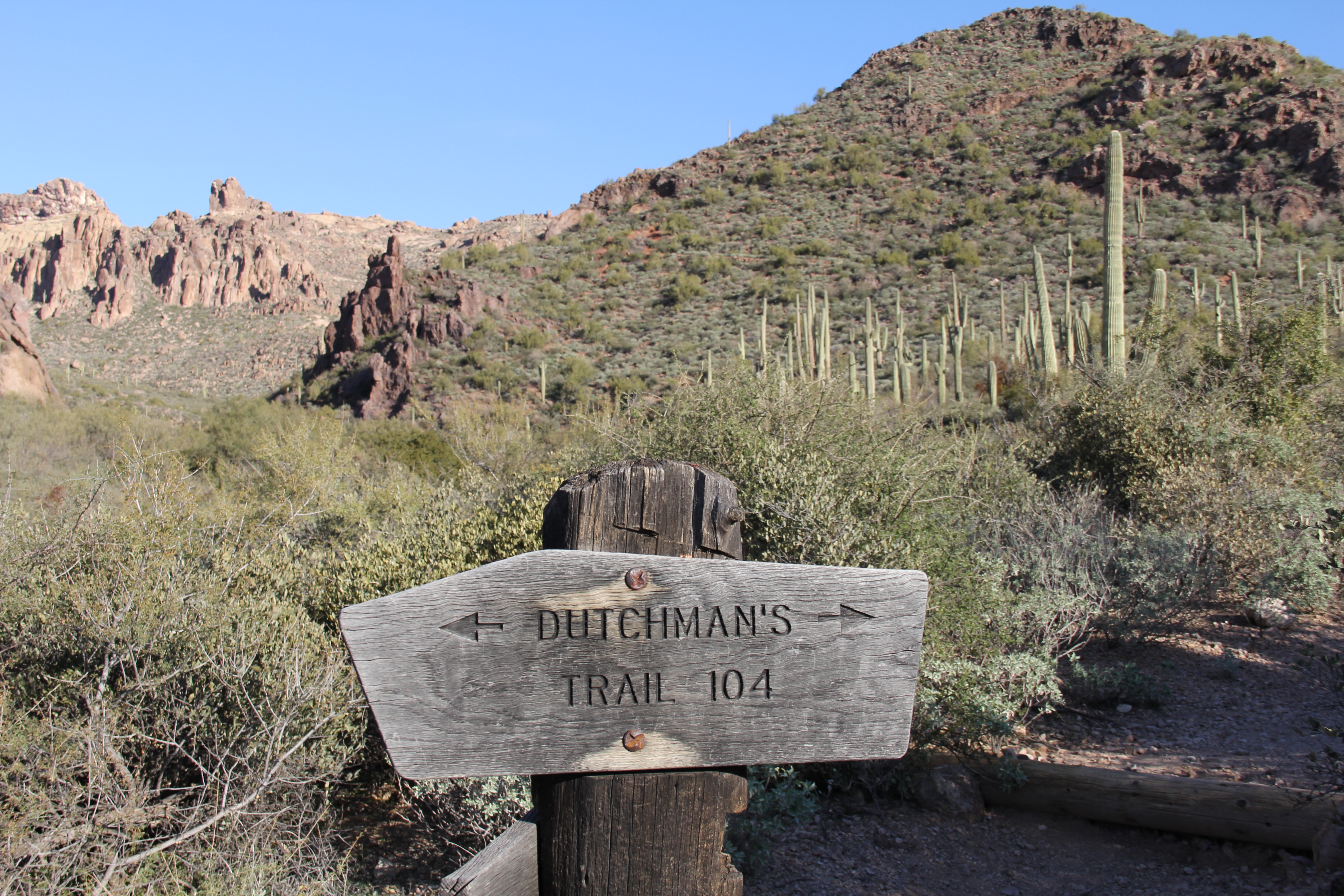
Wednesday (2/13) was another new “canyon” hike for the club, and like last Friday, a long one.  Tony did the “Lewis and Clark” work on this route, and it is a good one.  The destination for the day is Martinez Canyon, the location of an abandoned silver mining operation.

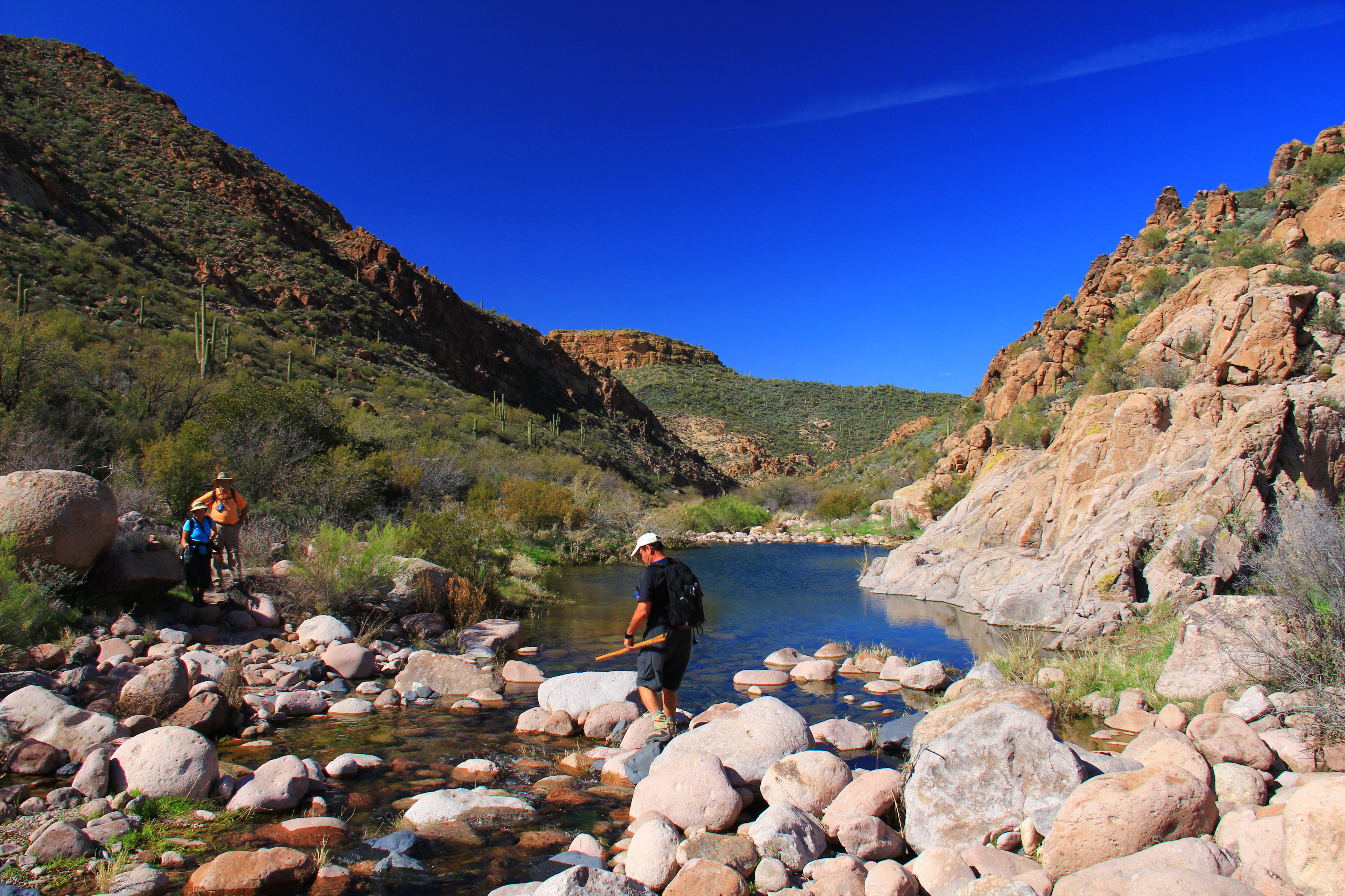
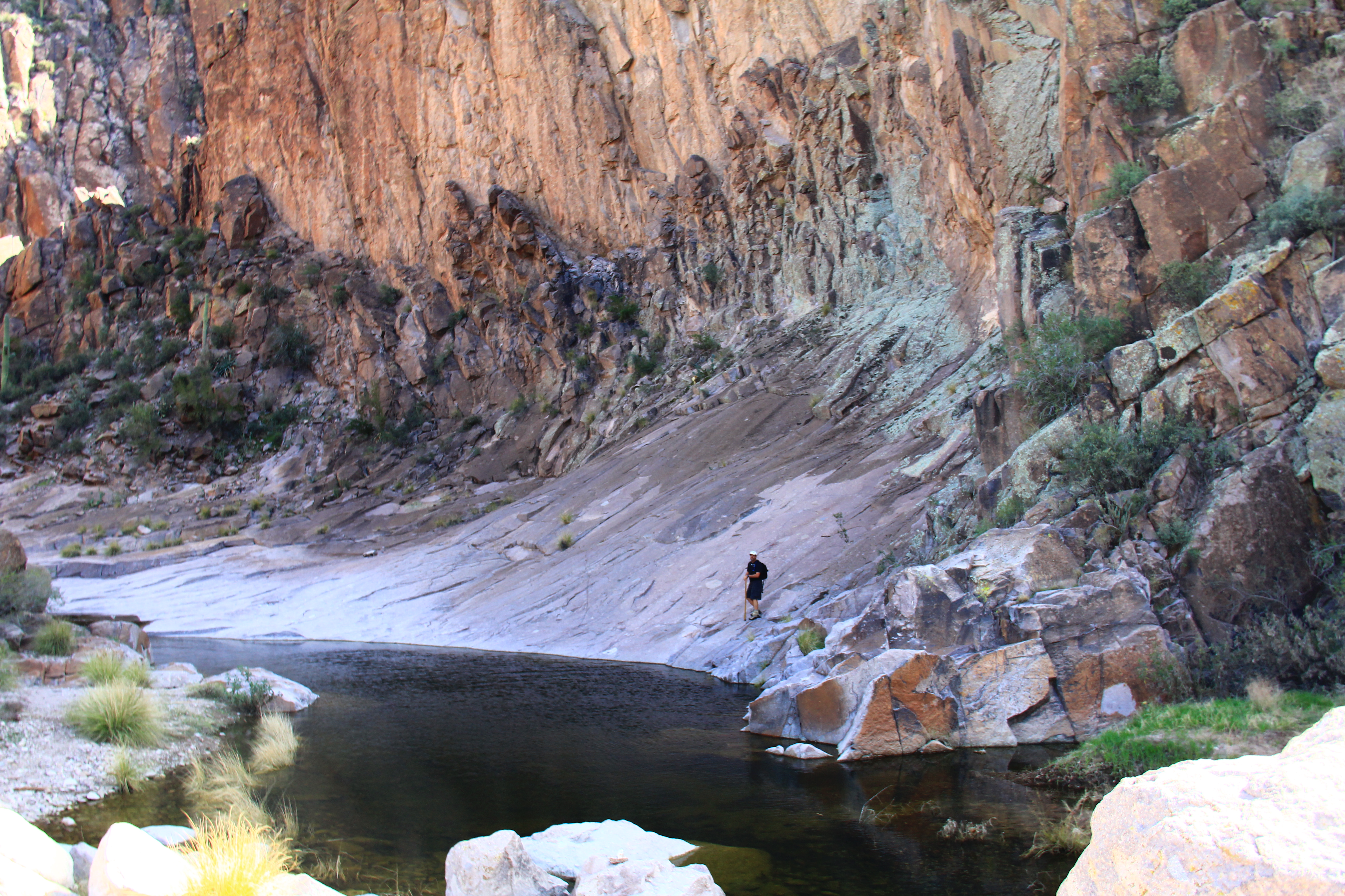
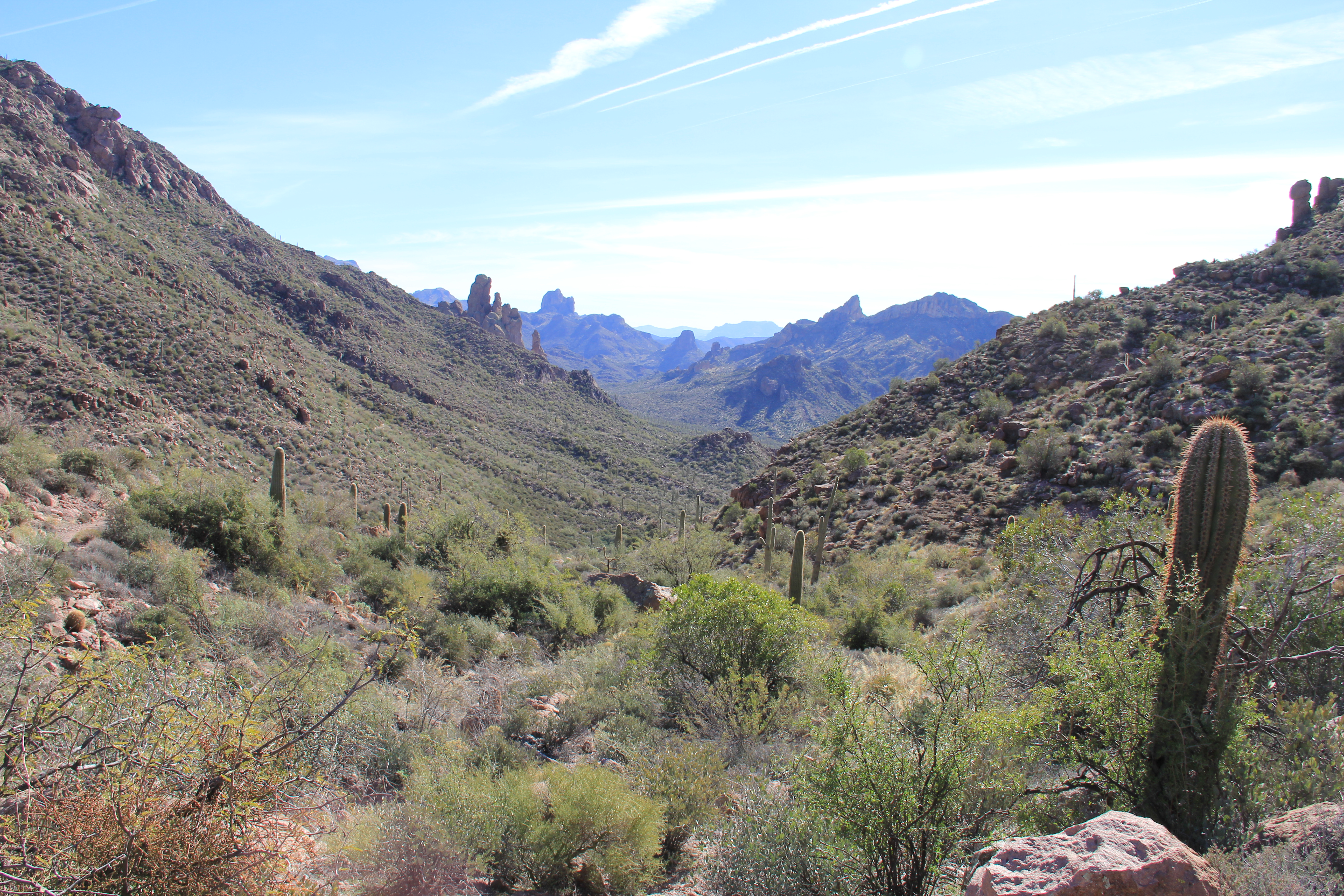
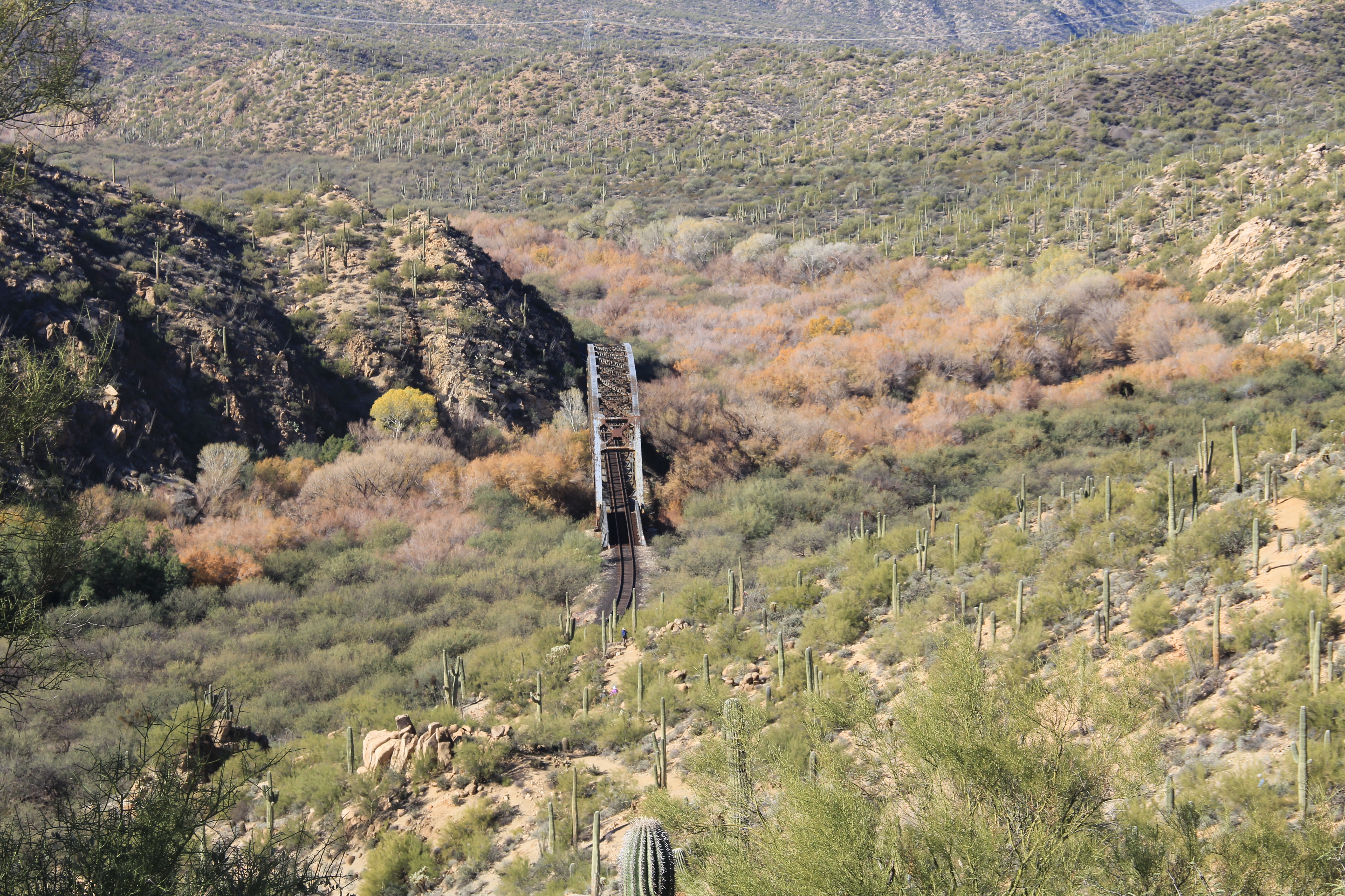
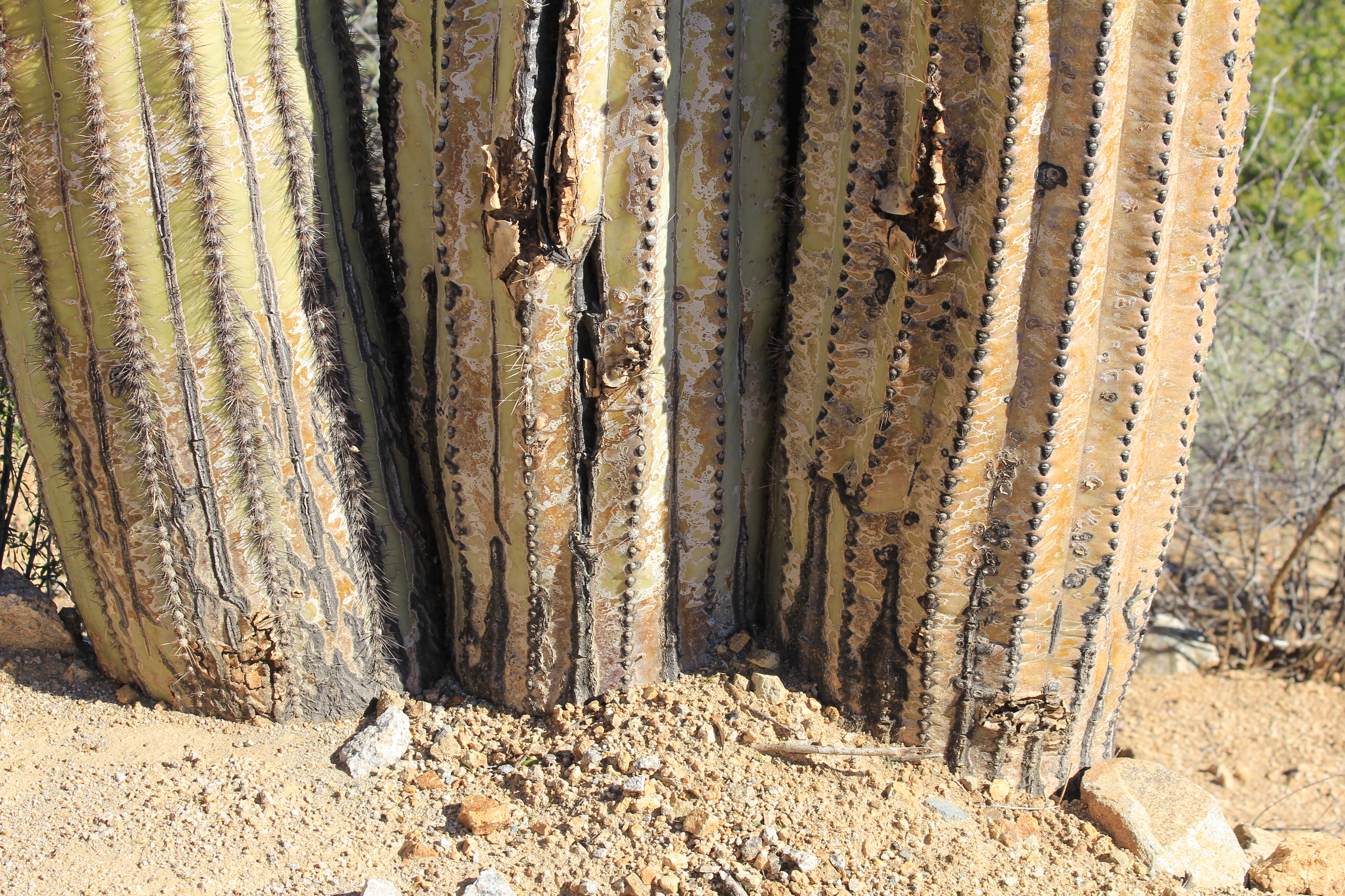
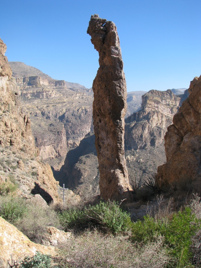
This 13 mile round trip starts in the familiar environment of Box Canyon, a pretty (and easy) couple of miles shared with Jeeps and quads from time-to-time.  Because of the deep shadows this is a challenging venue for photographs, but always a very visual experience.

Martinez Canyon 008

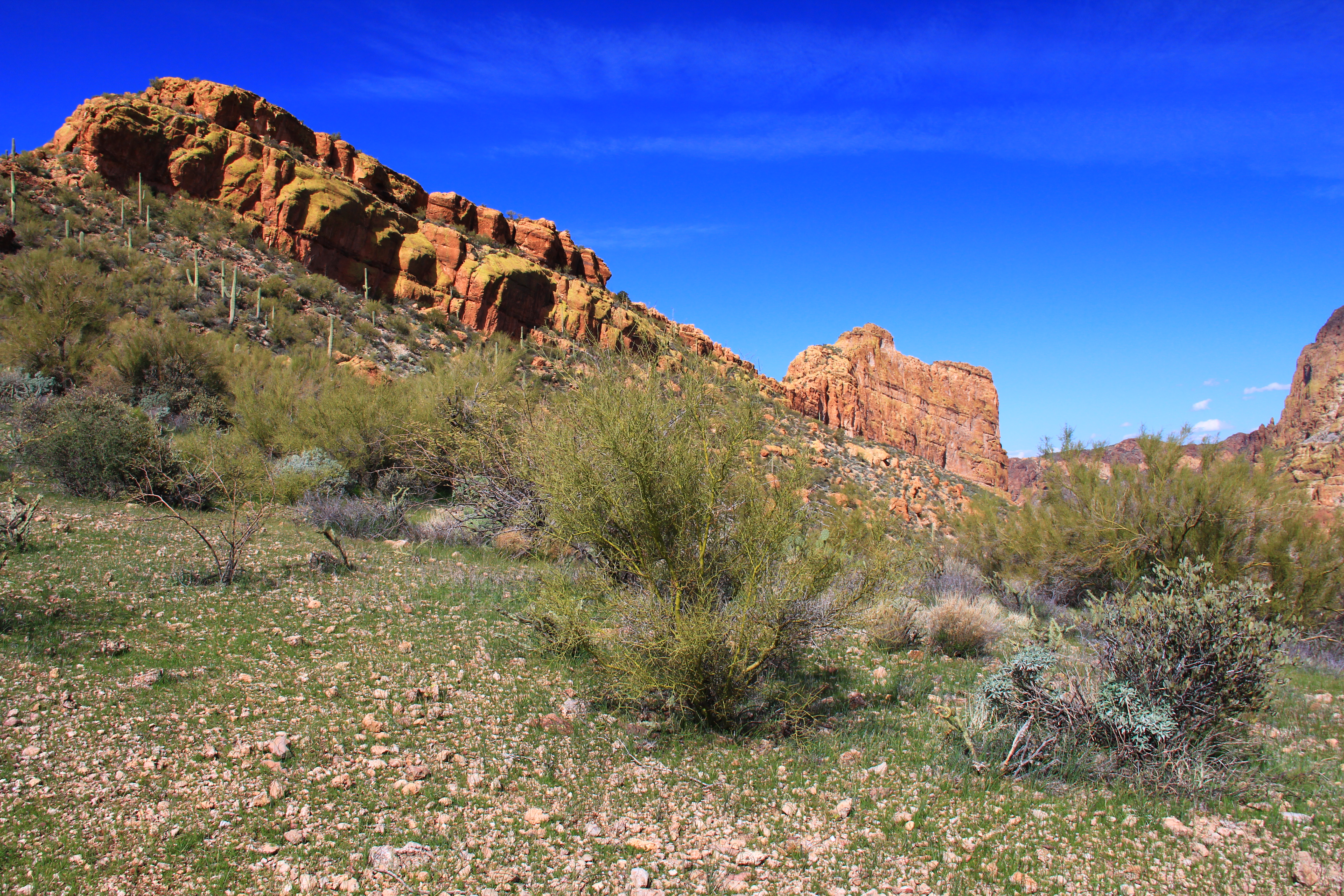
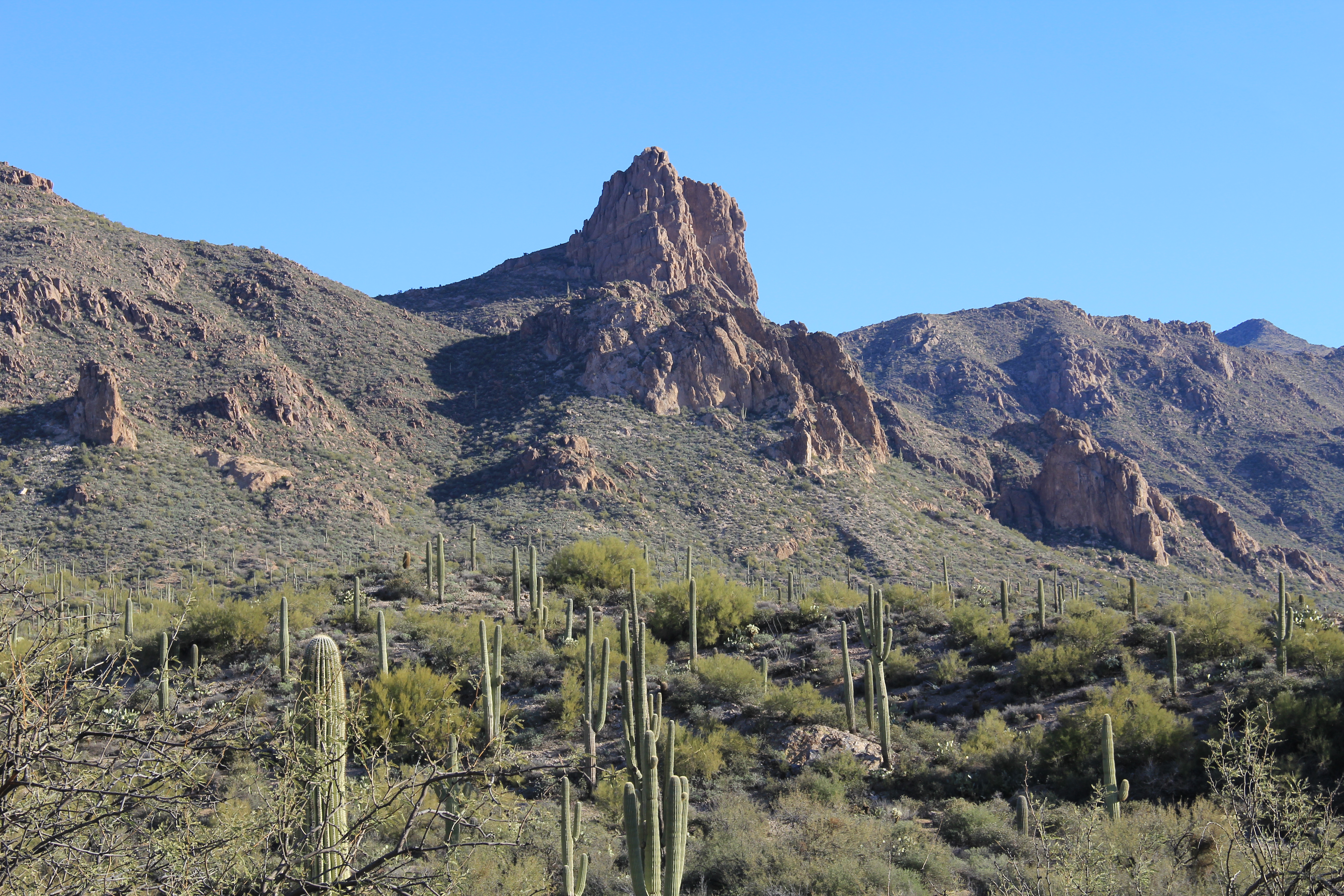
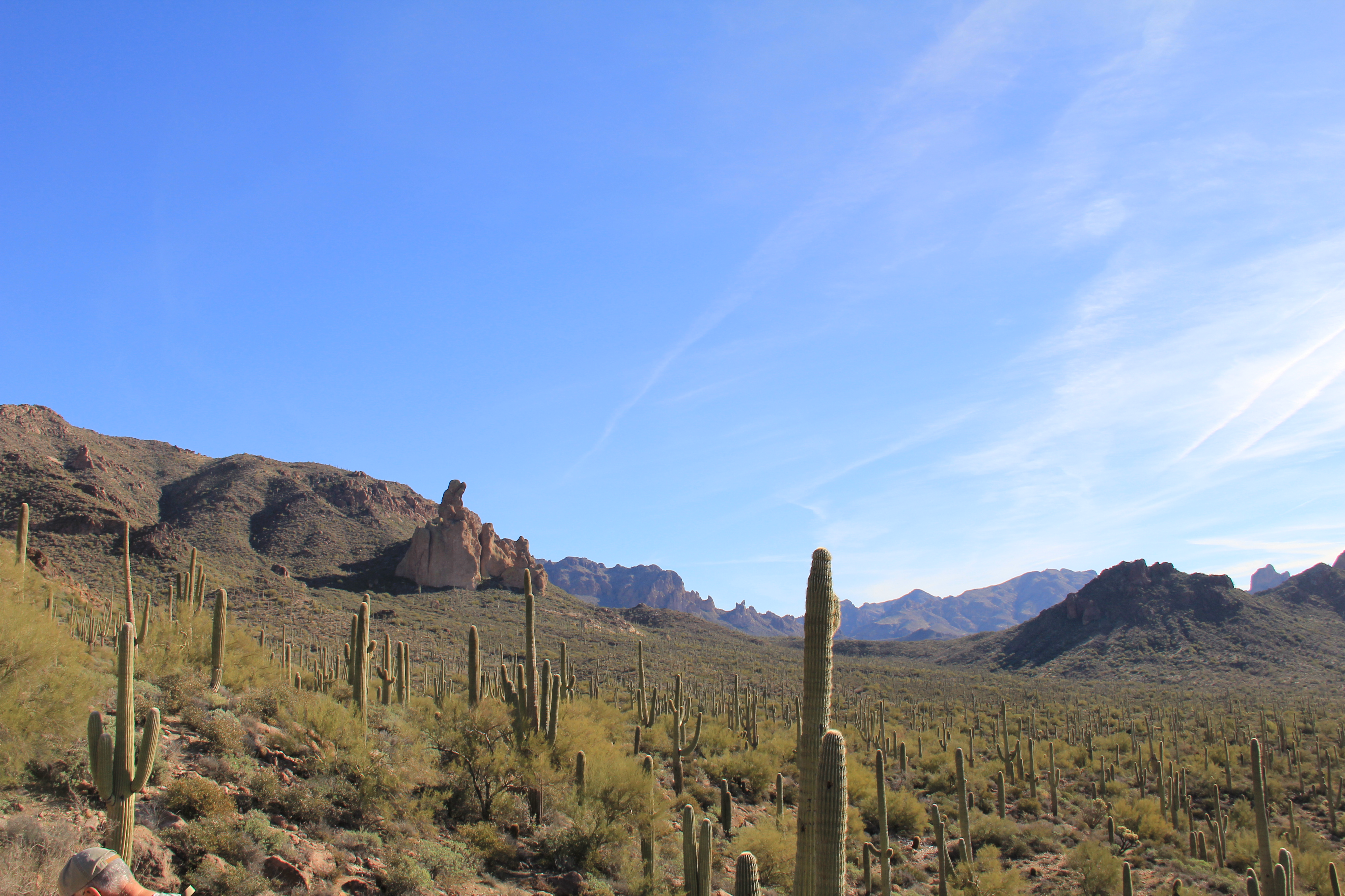
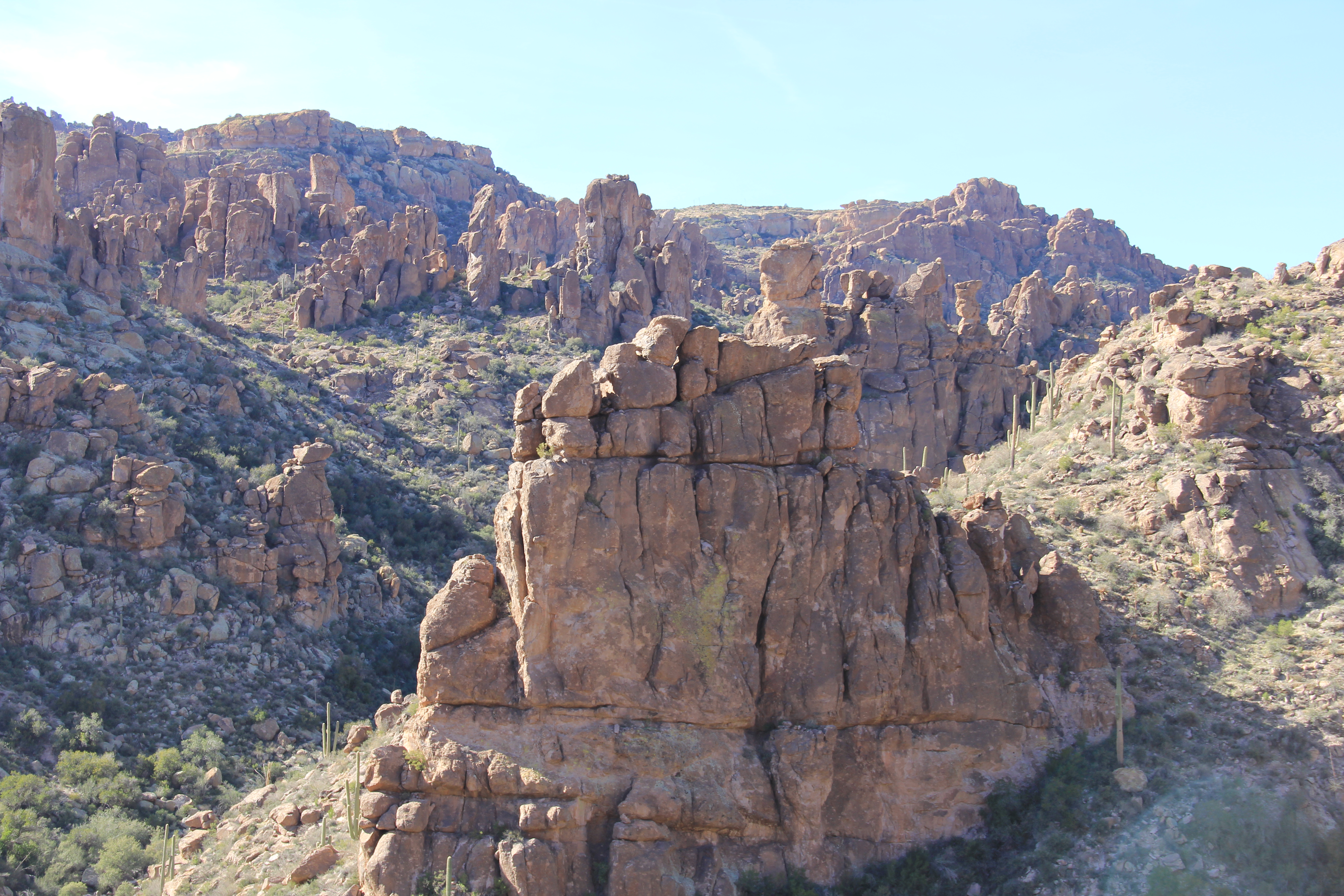
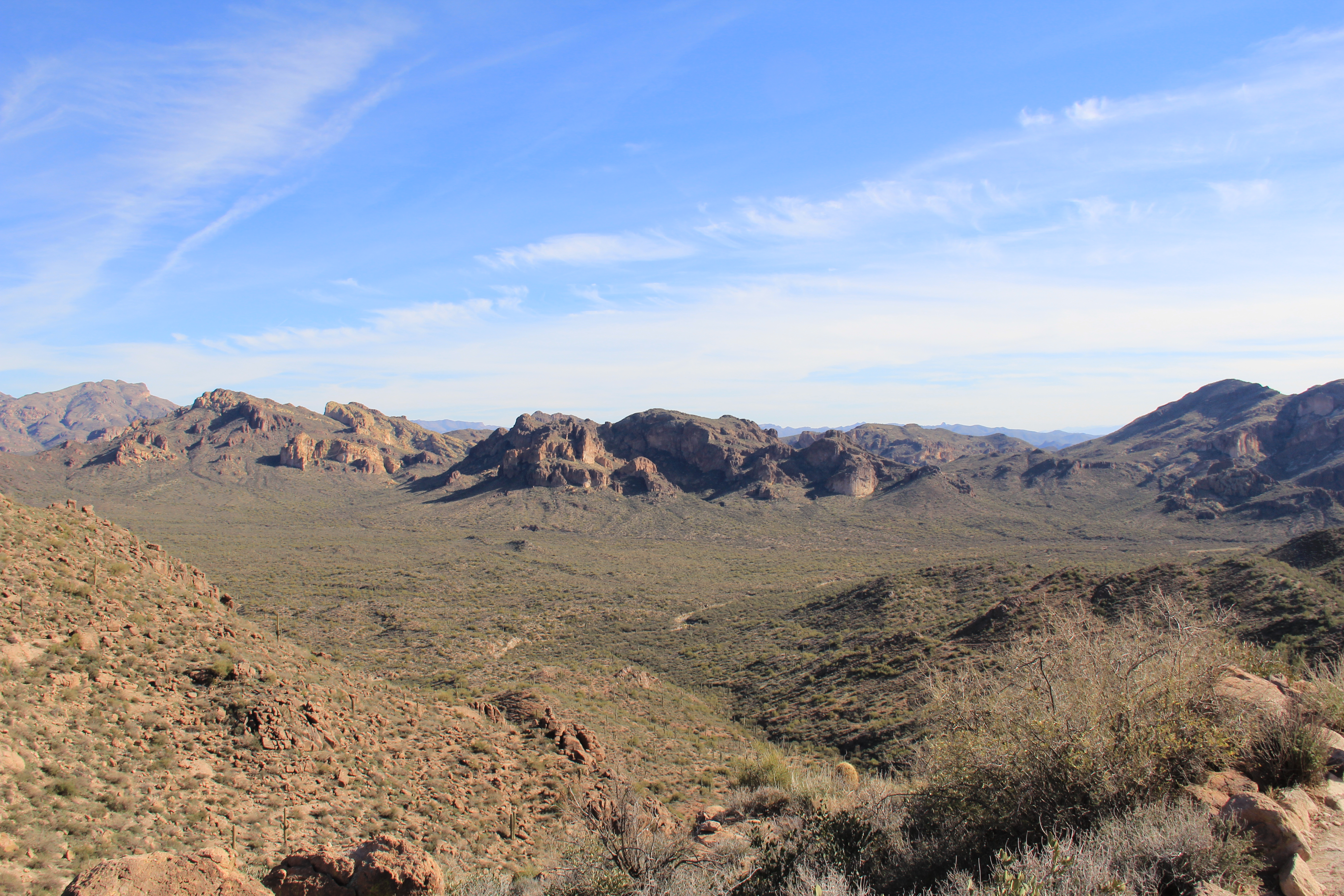
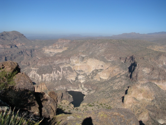
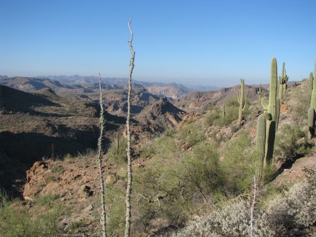
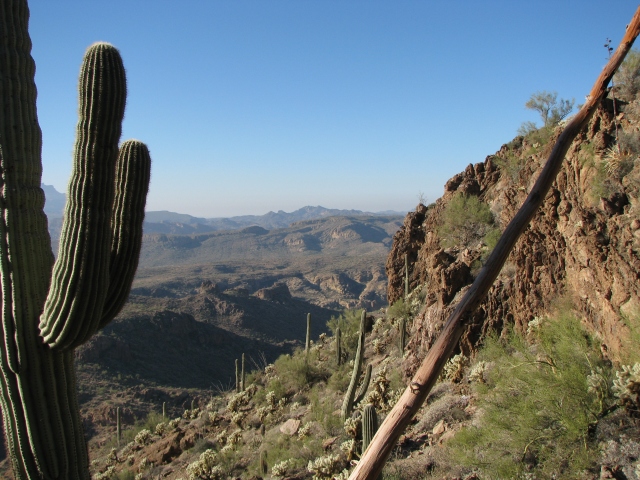
Leaving Box Canyon the route breaks out into an open area of broken bluffs and canyons.  We continue to use an old mining road (now a popular Jeep trail), so the walking is easy even though Dana’s GPS reports over 1,200 feet of accumulated elevation gain for the day.  Not worrying about your footing is a blessing which allows you to pay more attention to the scenery.

Martinez Canyon 035 Martinez Canyon 042

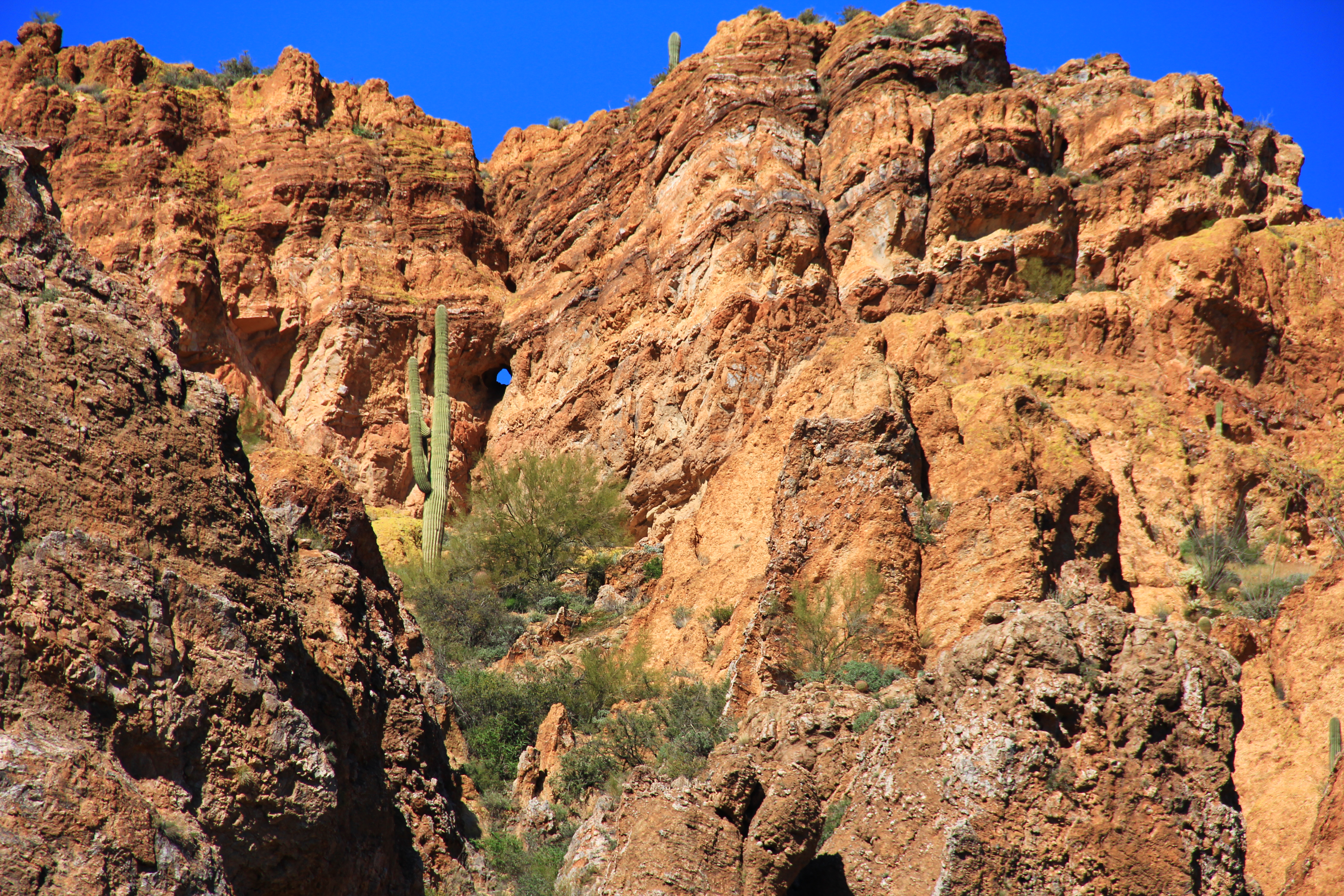
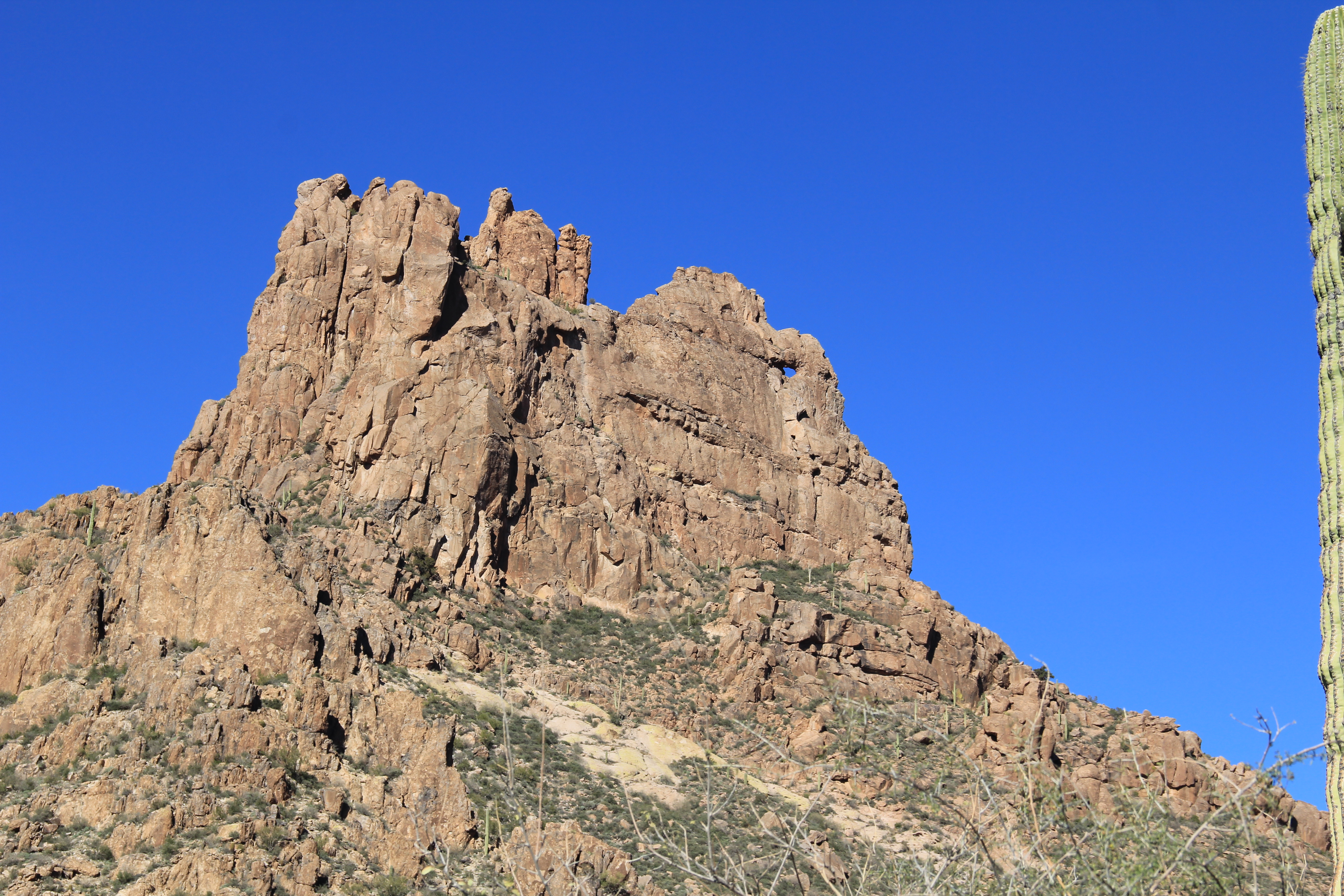
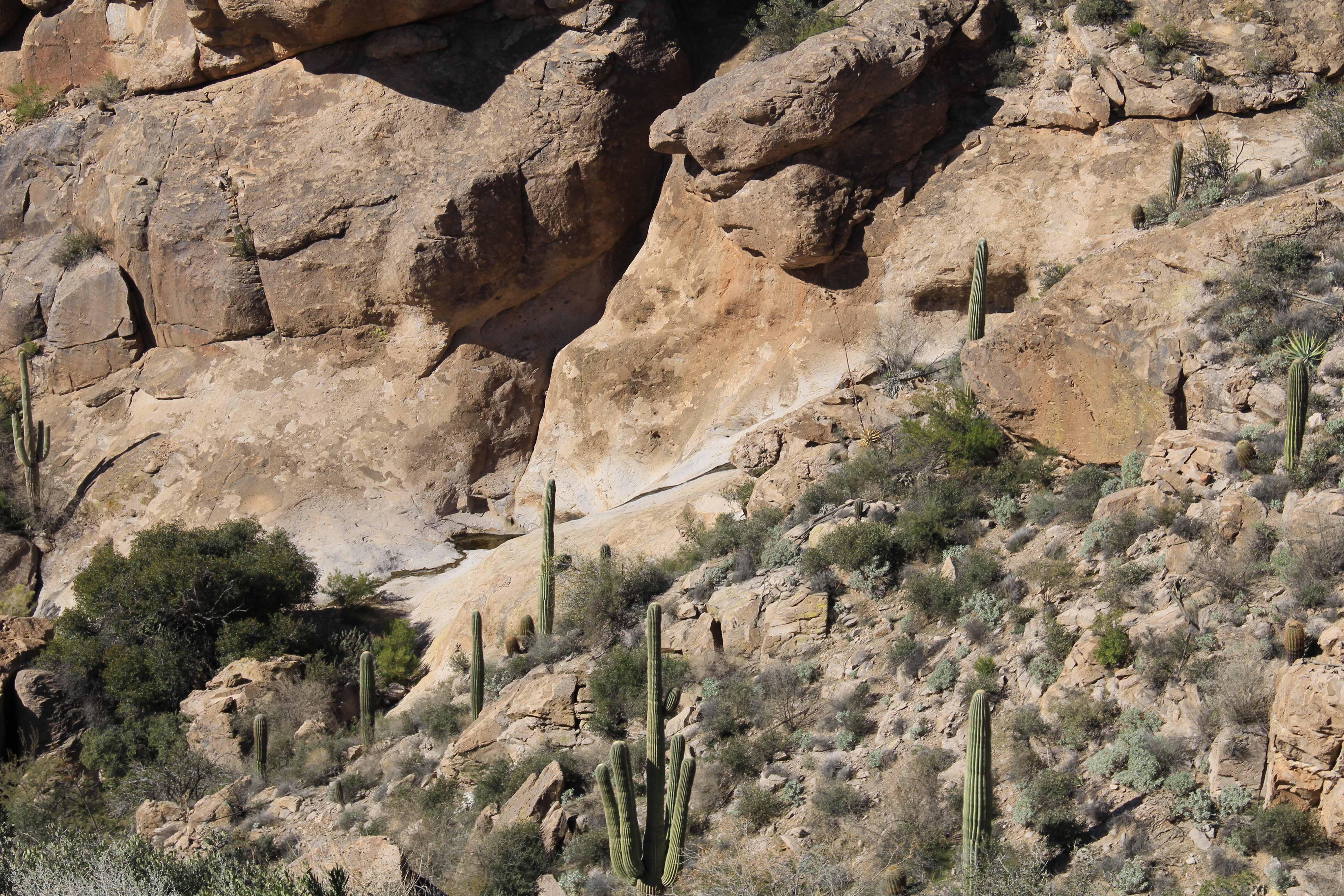
Can you spot the hole through the mountain above?

Martinez Canyon 063

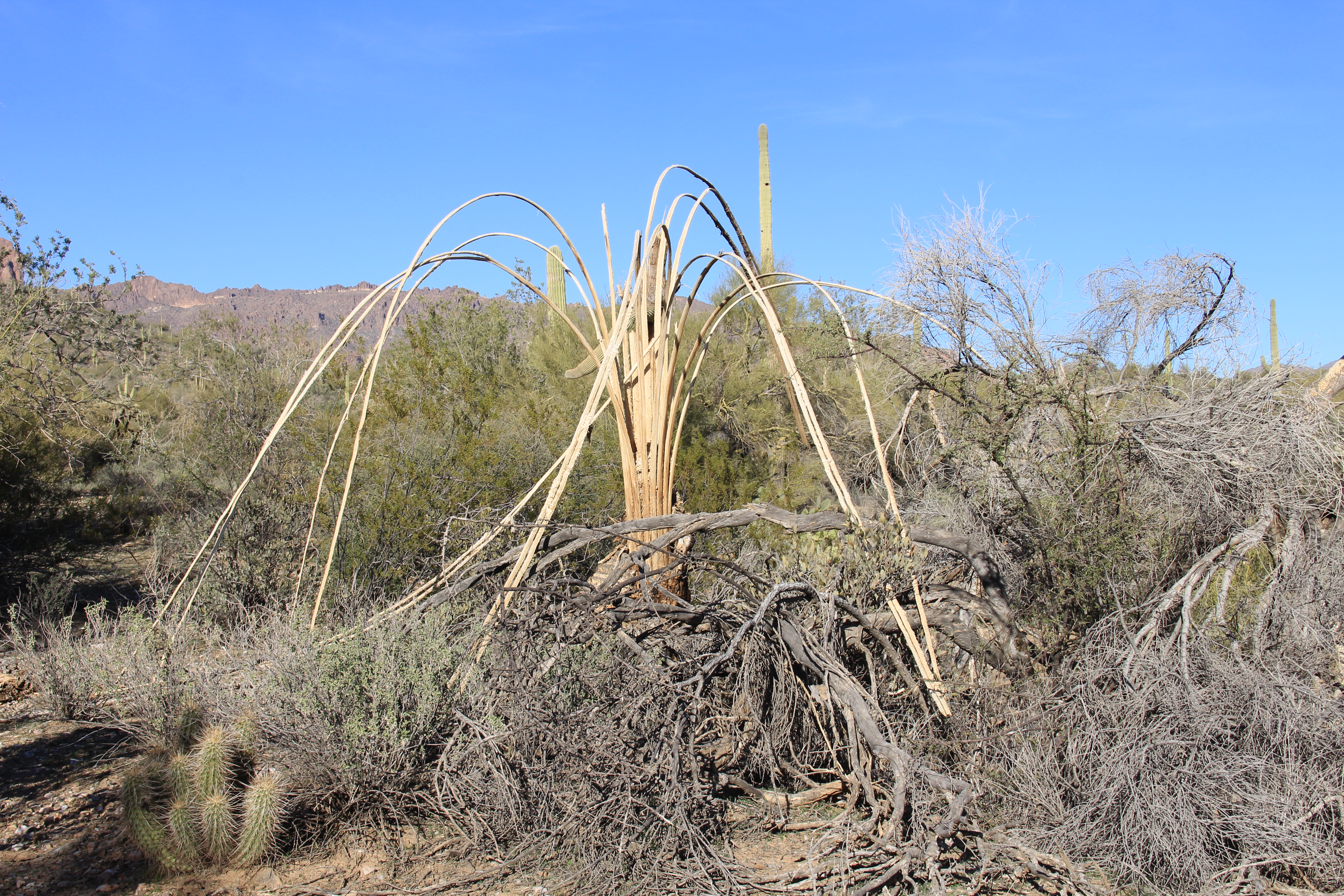
Scenes like this derelict abandoned corral (below) in a small canyon always trigger my imagination about the people who once made their life in these remote places.

Martinez Canyon 076

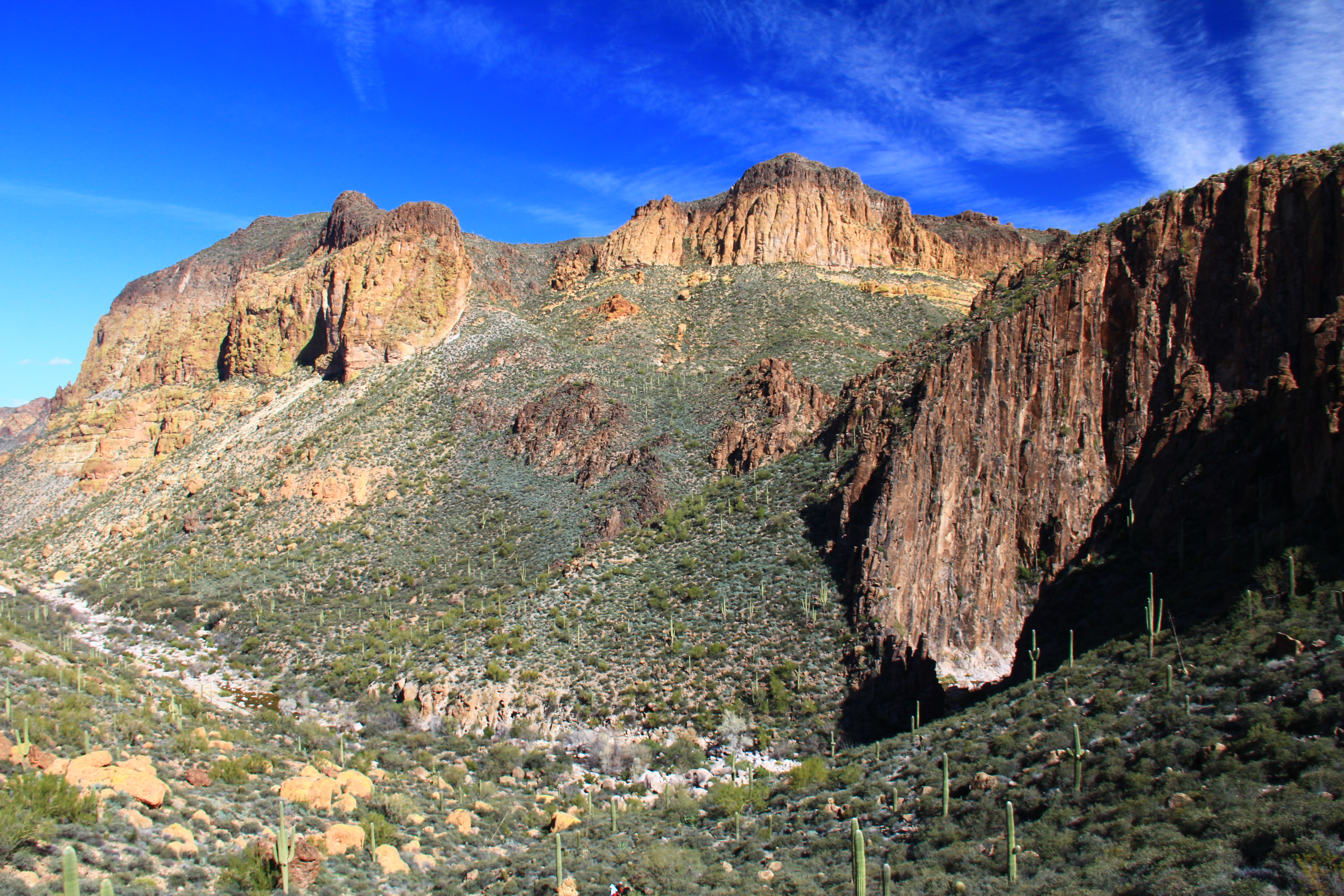
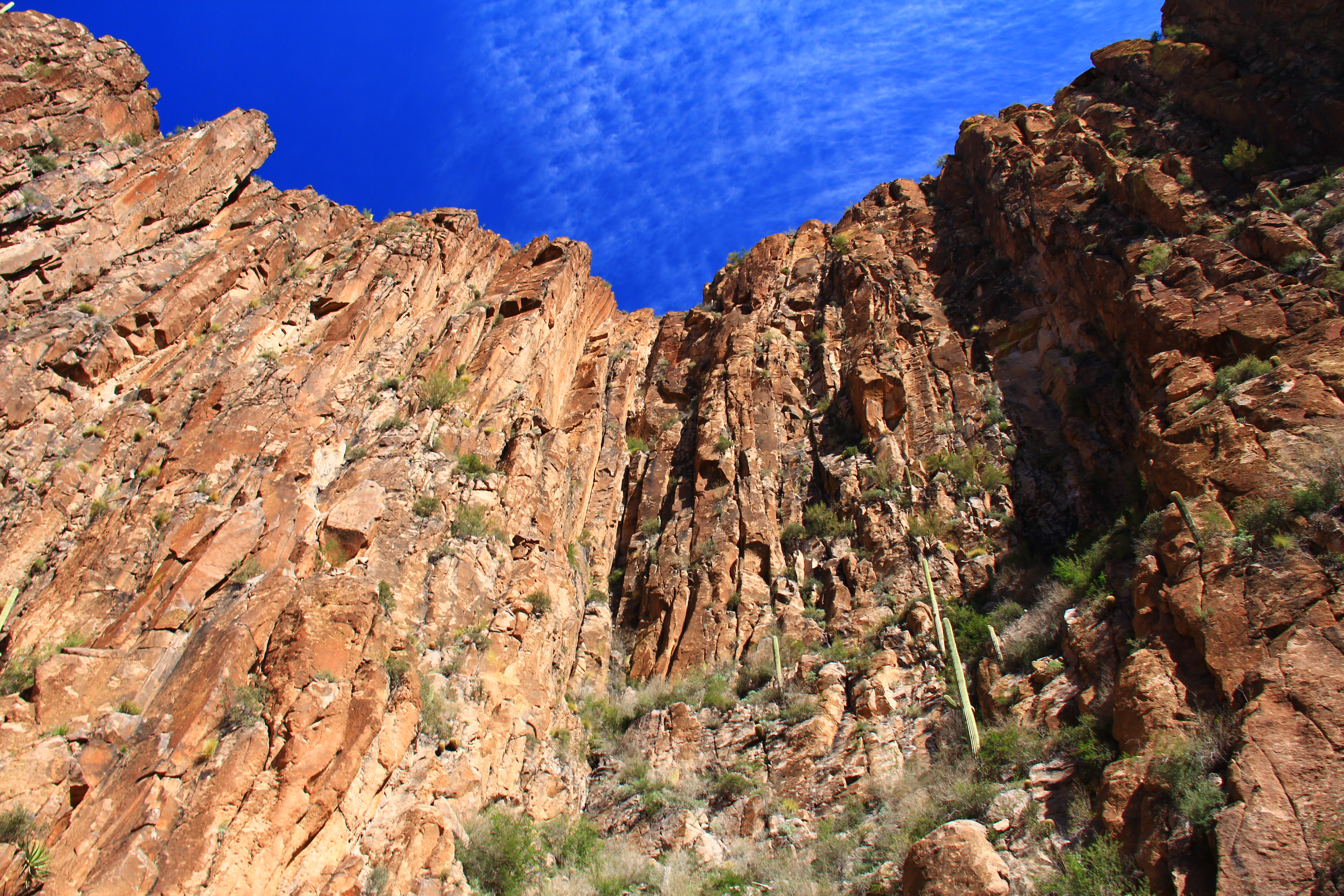
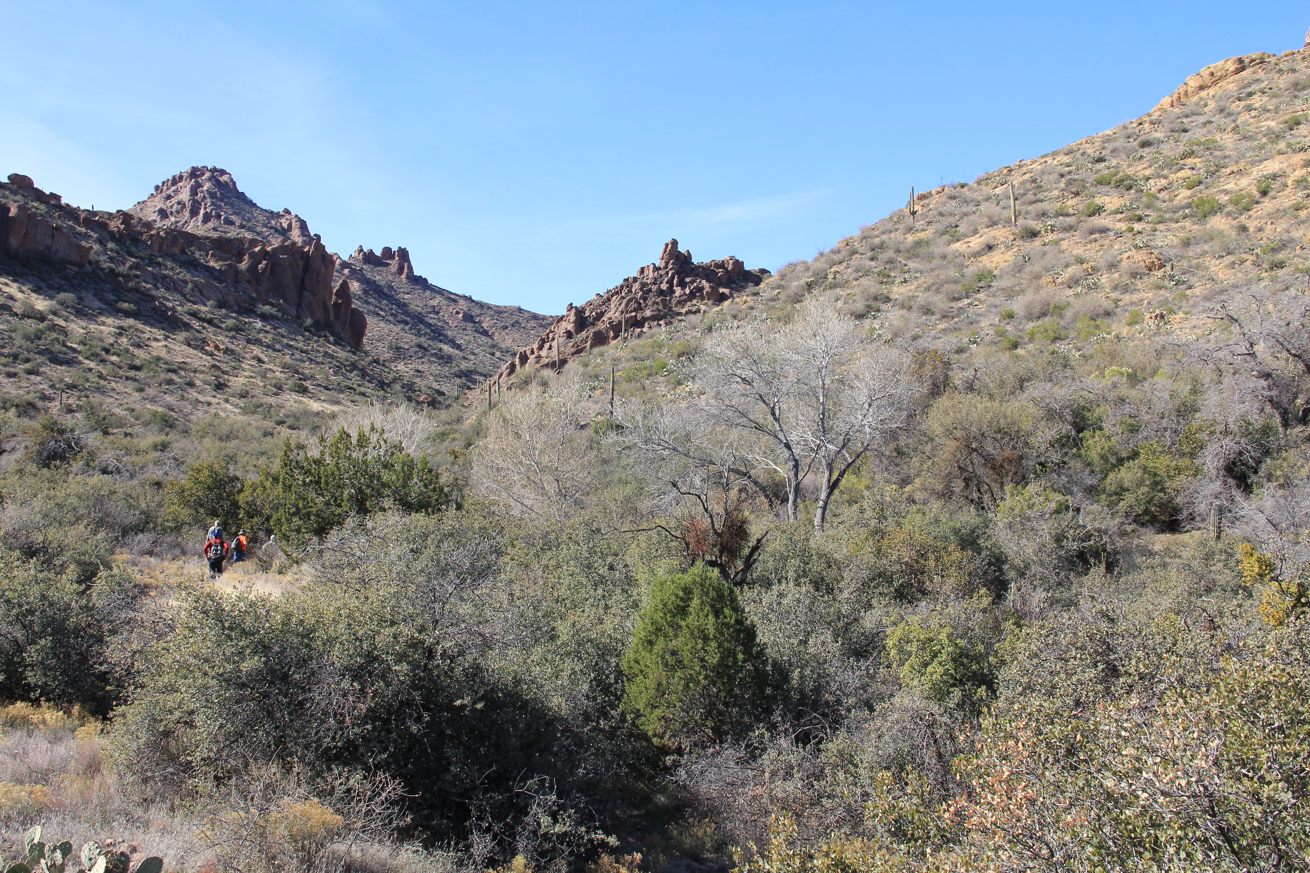
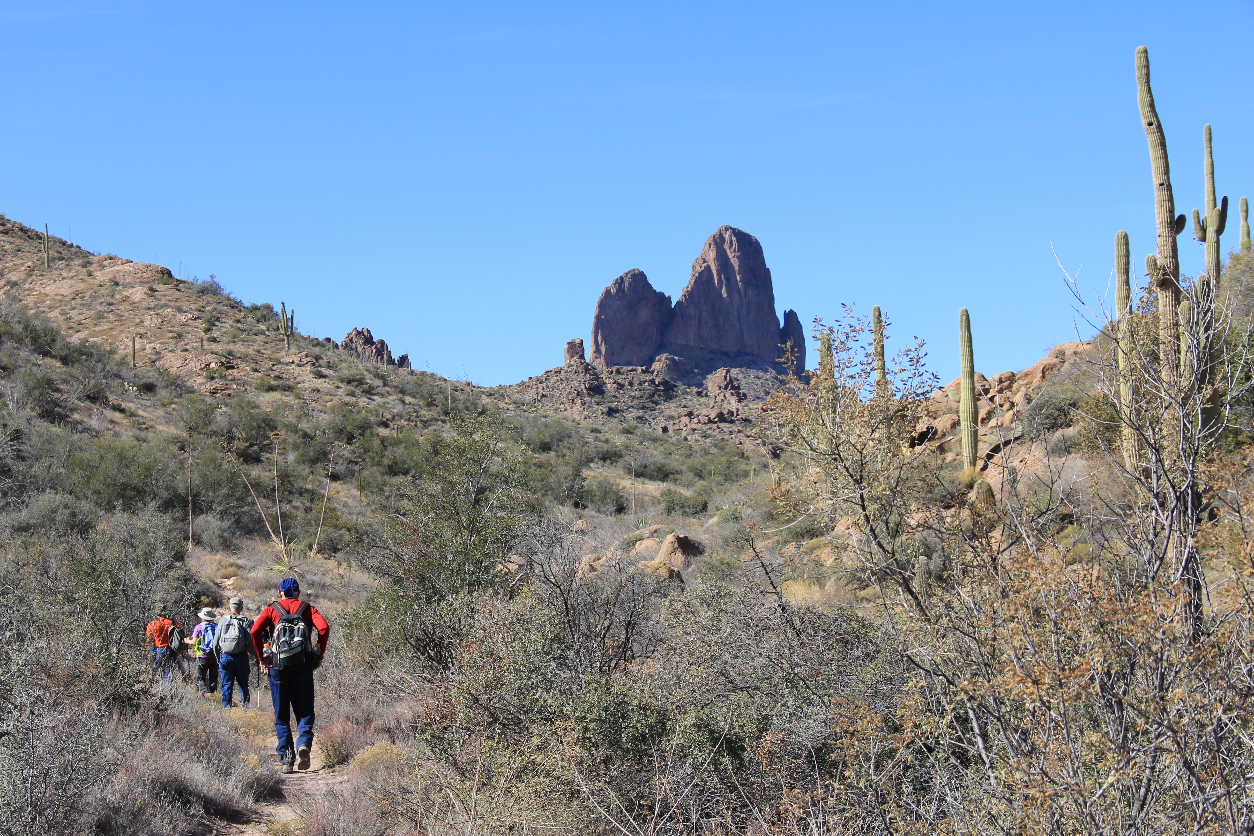
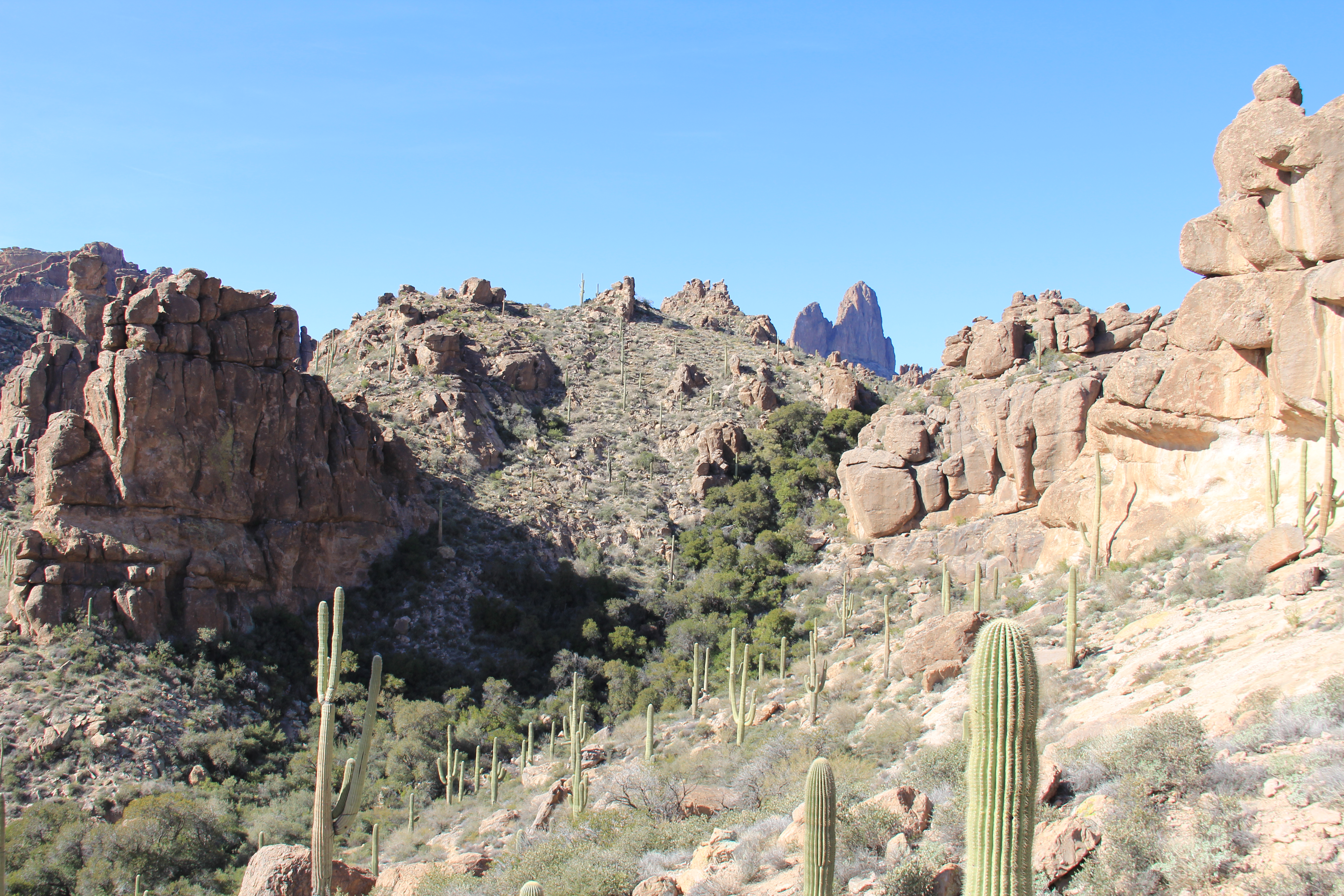
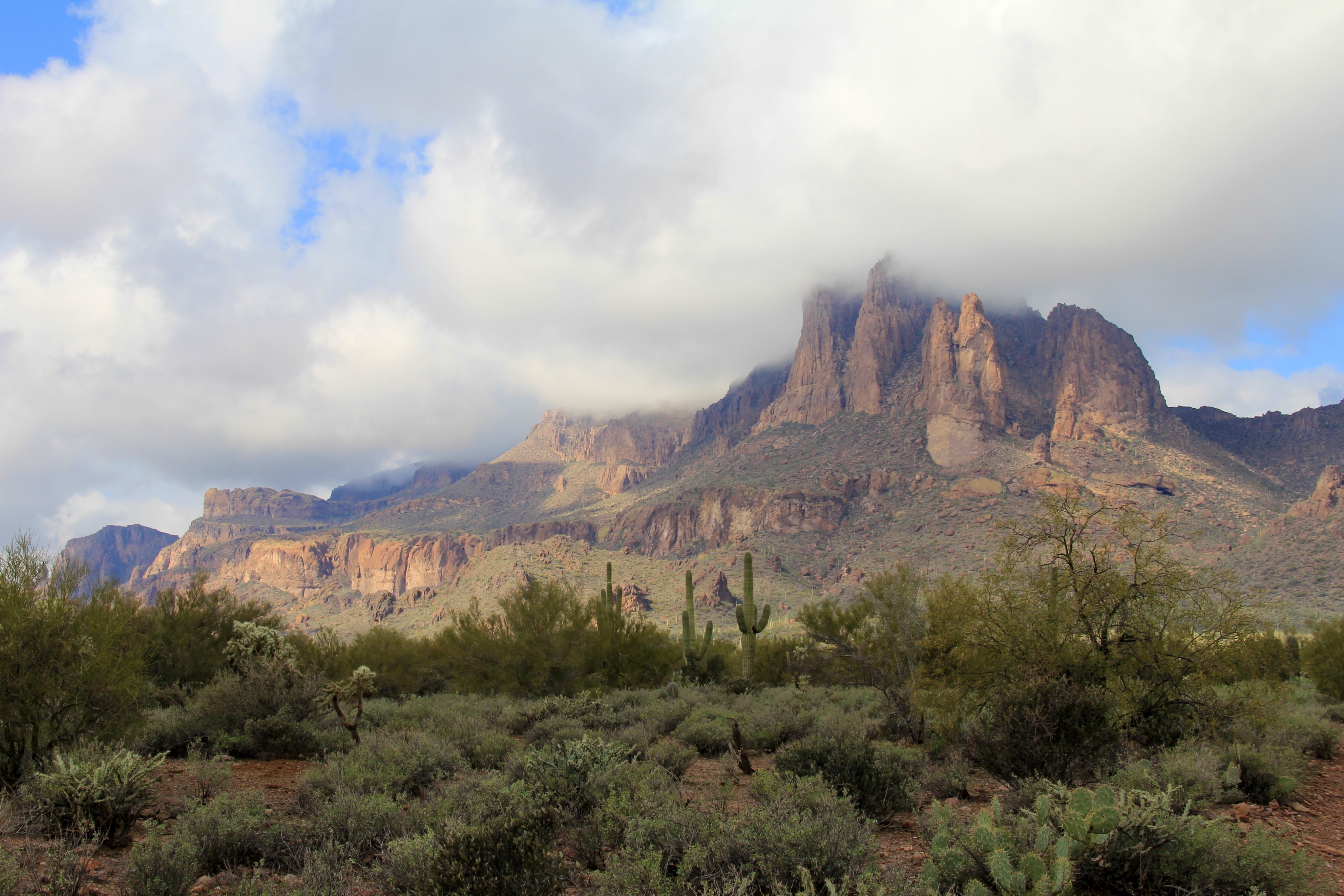
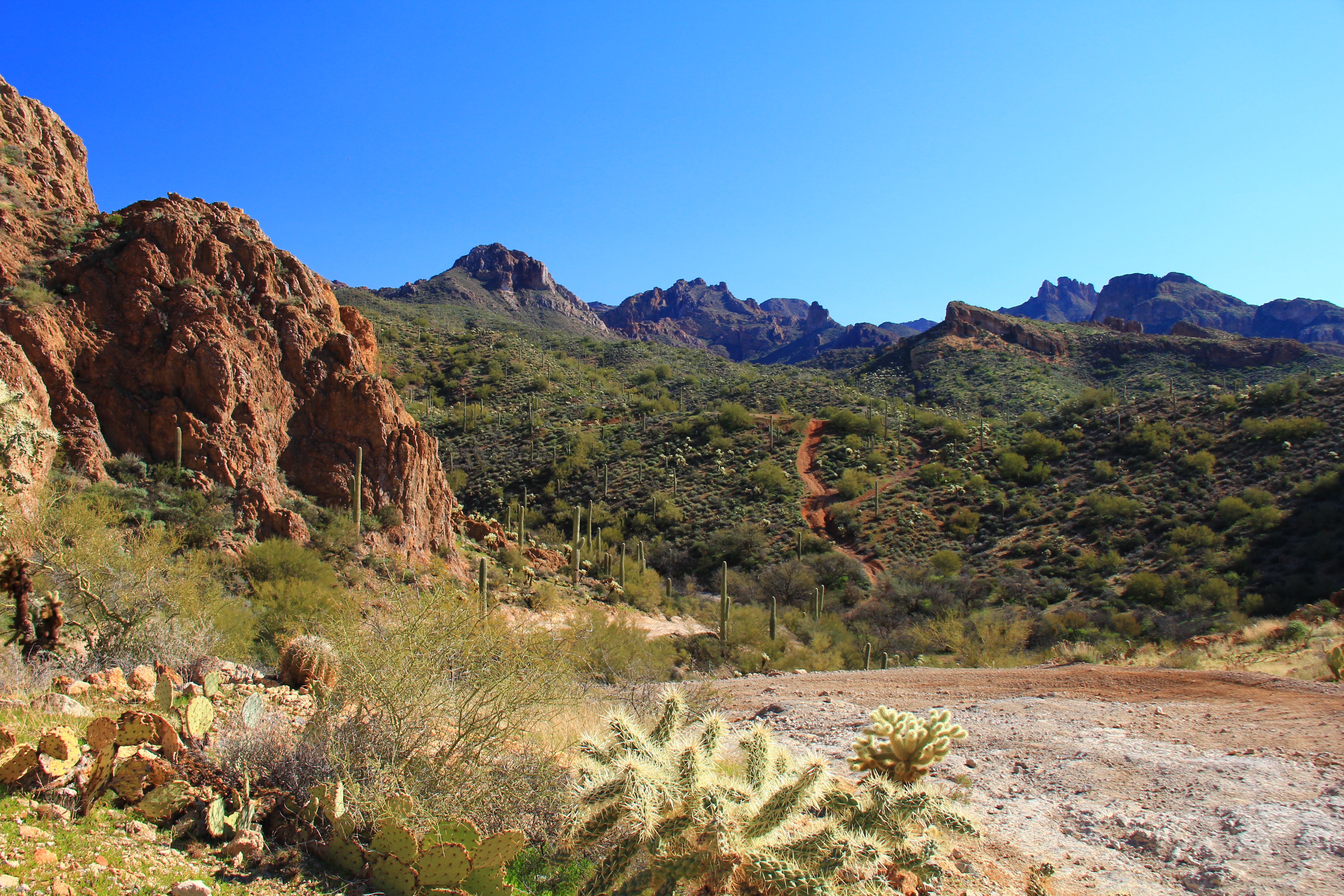
As we approach Martinez Canyon the scenery becomes much more eye-catching, and the rock coloration transitions toward “red rock”, much like  the kind which you see in the Sedona area.

Martinez Canyon 087 Martinez Canyon 089

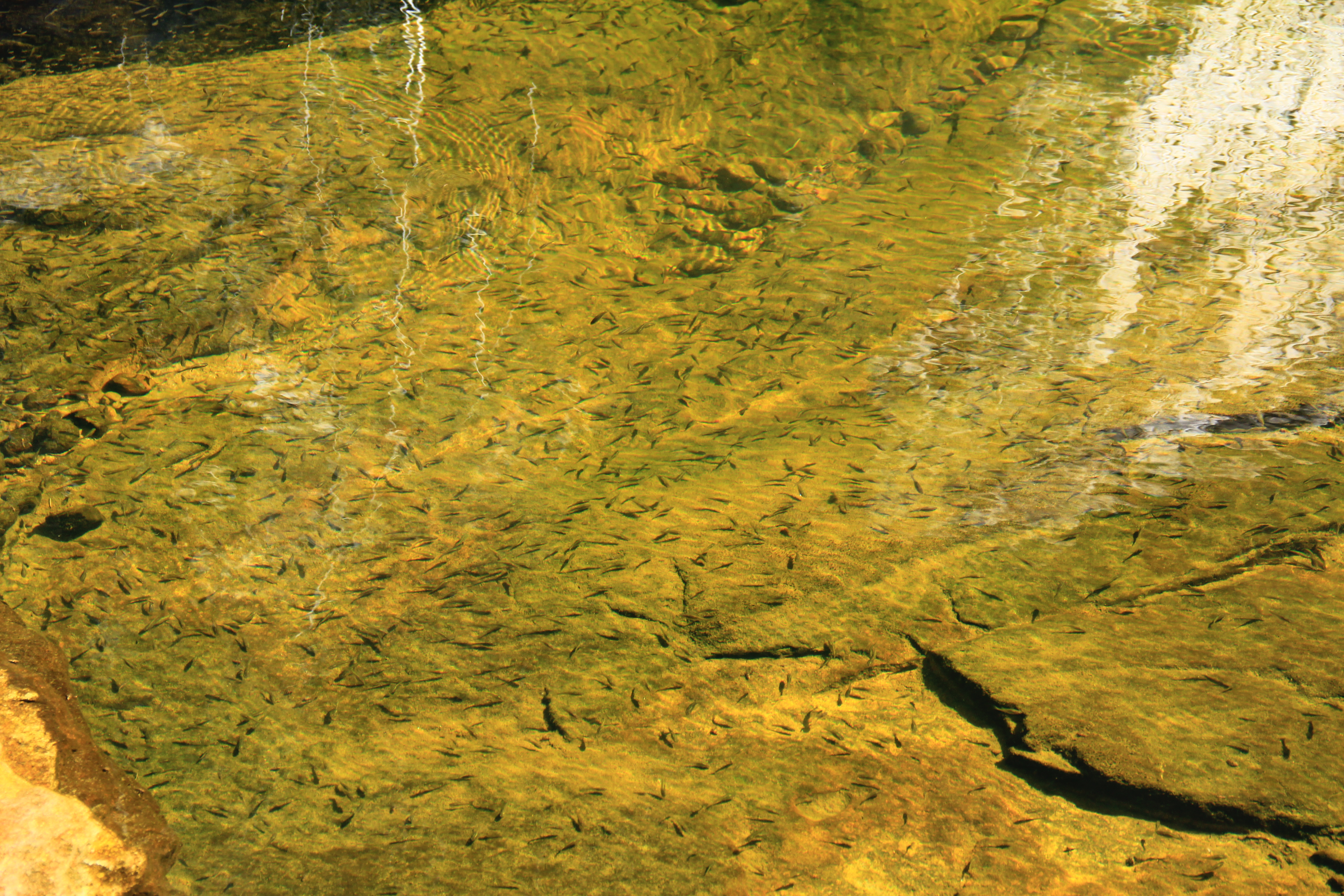
The interior of Martinez Canyon has a very riparian flavor.  Huge old cottonwood trees dominate the narrow canyon floor, hemmed in by steep rock walls.

Martinez Canyon 107 Martinez Canyon 145Here we find Debbie, Judy, and Katie posing at the entrance of one of the old mineshafts in the wall of the canyon.

Martinez Canyon 122

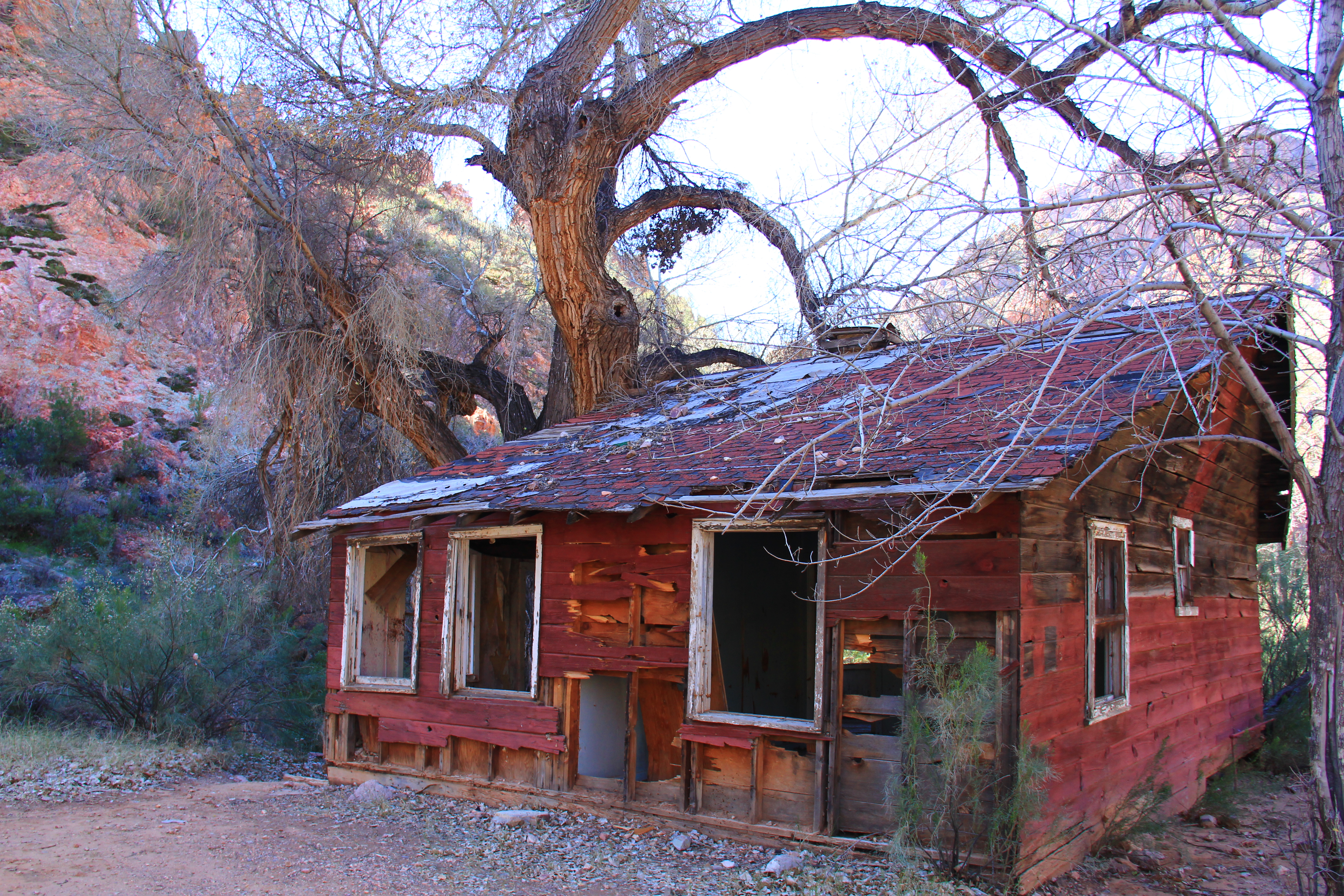
We took our lunch break at this old homesite, deep in the canyon.  What stories I imagine this old house could tell.

Martinez Canyon 127

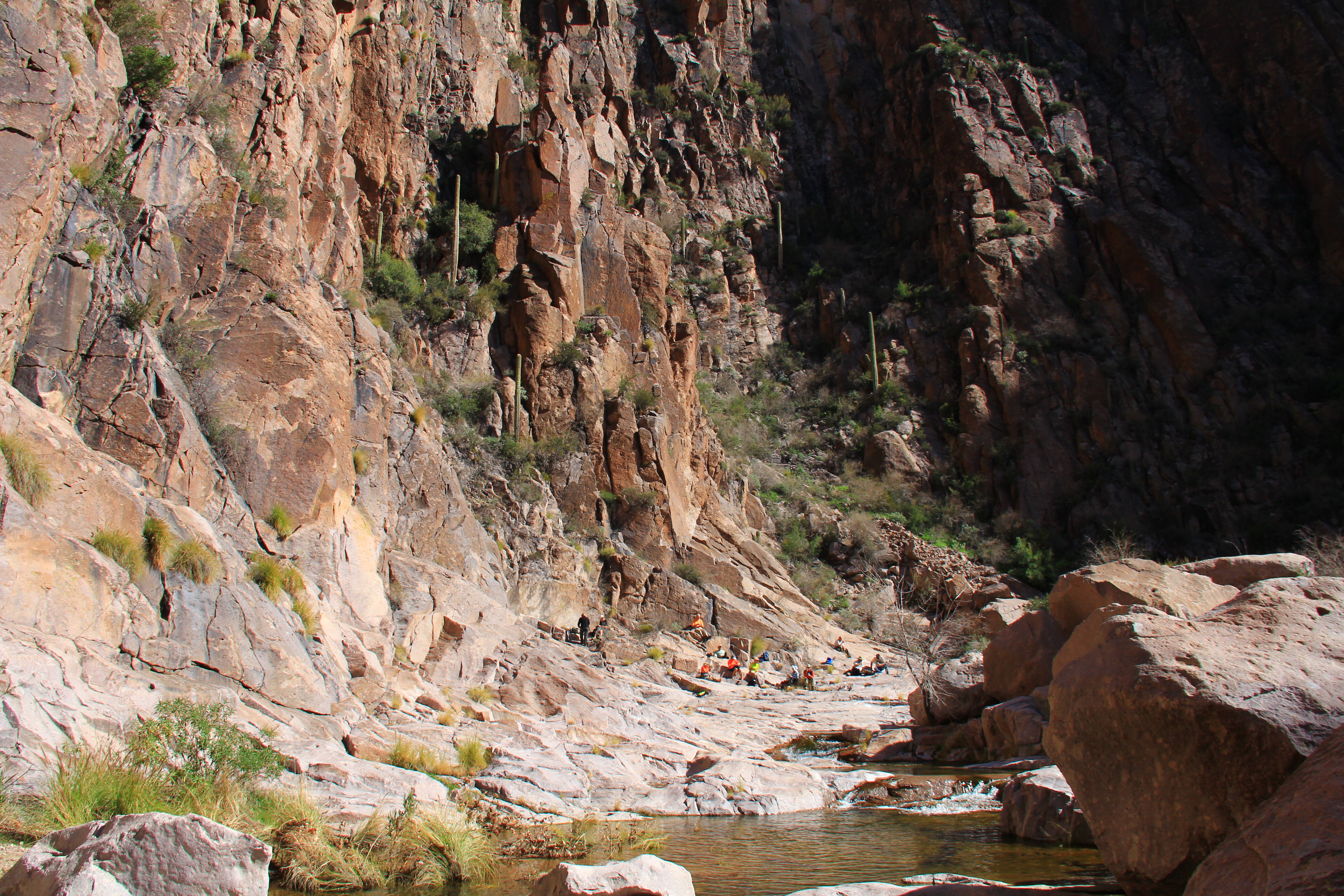
Only 10 of us took this hike.  Hopefully my description will “recruit” many more of you to make the trip next time around.  I’ll be there, because Tony, Peter, and Katie tell us of more sights “just around the next bend”.

The return route was over the same ground except that rather than come back down the length of Box Canyon, we took an earlier slot canyon route, about 2 miles in length, which is too narrow for ATV’s.  (This is the second half of the “Box Canyon Loop” route which others in the club hiked in place of the Martinez Canyon loop.)

This segment has an isolated character, and a few minor boulder choke points which showcase the athletic agility of some of our hikers.

Martinez Canyon 174 Martinez Canyon 178

A small commercial here.  I will not be hiking next Wednesday (Feb 20) because I will be displaying some of my photos in handmade frames at the Canyon Vistas crafters show, trying my hand at the “starving artist trade”.  Drop by after the hike.

Posted in Arizona hiking | 3 Comments

LaBarge Narrows — a Geology Lesson


You all know how I love a hike with a “reward” — for example the cliff ruins on Rogers Trough, the panorama dominated by Weavers Needle at Fremont Pass, the petroglyphs at Heiroglyphic Canyon, and the canyon views on the road down to Horse Mesa dam.

Add the Narrows of LaBarge Creek to that list!

Before I get carried away with the description of this excellent hike, I need to point out that it isn’t an easy trip.  It’s more than 11 miles long, and you accumulate a total of over 1,800 feet of elevation gain (and loss) according Dana’s GPS.  Yes, that sounds tough, but pace yourself and even a codger like me can do it.  It’s all “stand up hiking”, not “4-legged” hiking like segments of Picketpost or Flatiron, and the ascents are interspersed with long segments of flat ground to rest your legs.  The usual caution to bring lots of liquid REALLY applies.  Even though it was a coolish day (high 60’s), I went through over a gallon of water and GatorAde.  I’m also compelled to thank the several fellow hikers who hung back to keep this slowpoke company, especially Lin who sheep-dogged me up that last ascent out of Boulder Canyon.  CVHC rocks!

The route we took is a “custom” route stitched together by Jim Hardy, not the “official” route from Canyon Lake trailhead that you’ll find at all the usual published sources.

The first segment of our hike is the familiar route leaving First Water trailhead up to Garden Valley on Lost Dutchman/Second Water trails.  At the Indian ruins where we usually turn north toward Hackberry Springs, or south over Black Mesa, we continued on trail 236 eastward toward a notch in the valley wall.

LaBage Narrows 003

As you leave Garden Valley the trail passes from smooth walking into an area covered with volcanic ejecta, and the footing gets a little gnarly.  Wear strong shoes!

LaBage Narrows 008

From here the path descends for about a mile down a minor side canyon past Second Water Spring into Boulder Canyon.

At the bottom of this descent we joined the Boulder Canyon trail and headed south along the port side of Battleship Mountain, the formation seen in the right of the photo below.

LaBage Narrows 022

Boulder Creek is carrying a fairly nice flow of water, and during the mile or so that we followed it, we had to cross it 11 times (and 11 times more on the return).  To my knowledge, no  feet got wet.  We are a pretty agile group of old coots!

LaBage Narrows 114

After about a mile we left the trail, took a left turn, and headed cross-country on a rather faint unofficial “use” trail up and over Battleship Mountain just astern of the “ship” on top of the mountain.  The descent on the far side of the mountain dropped us into La Barge Canyon a short distance downstream from the “Narrows”.

Here is a starboard side shot of the “battleship” taken during the descent, with the bow pointing to the right of the picture.

LaBage Narrows 058

In the next photo, zoomed a bit, you see the bow of the ship on the right, and on the left another sandstone formation named Geronimo’s Head.  The disconnect was carved over the centuries by La Barge creek, seen far below.

LaBage Narrows 070

Panning the camera to the right (in the photo below Geronimo’s head is now at the left of the picture) reveals an interesting view of the violent geology of this area.  Embedded in the sandstone of Geronimo’s head is a cone of basalt (the dark rock at the right “foreground” third of the photo).  This is the solidified remains of the interior of a volcano, revealed by erosion from the creek over many hundreds of thousand years.

LaBage Narrows 069

The contrast between the two is quite a bit more striking “in person”.

At the bottom of our descent into La Barge, we found it also contained a good flow of water.  In this pool if you look closely you can see a population of small minnows, indicating a permanent and reliable source of water even in the dry season. (Purify before you drink any wilderness water.)

LaBage Narrows 095

Turning right when you reach La Barge creek, we have arrived at our destination, the “Narrows”.  This is a narrow cleft, with shear vertical walls hundreds of feet high, which the creek has carved through hard rock at the heart of the basalt cone.  Because of mid-day direct sunlight it wasn’t possible with my skillset to get really good photos of this narrow cleft, but hopefully the views below will whet your appetite enough to make the hike to see for yourself.

LaBage Narrows 076

LaBage Narrows 083

LaBage Narrows 099 LaBage Narrows 100

Posted in Arizona hiking | Tagged | 7 Comments

Bluff Springs Loop – A Superstition Sampler


Nine and a half miles.

One thousand, five hundred and forty one feet of accumulated elevation gain.

Hundreds of great photo opportunities, and a real sense of accomplishment.

Today (Friday, 1/18/2013) the hike was the “Bluff Springs Loop” in the Superstitions.  Yes as you see in the introduction above, it’s a little bit of an “ambitious” hike, but today was a perfect hiking day, temps in the 50’s  at the morning trailhead and low 70’s later in the day.

Like all loops, you can do this one either clockwise or counter-clockwise.  For us “mature” codgers, this one works best counter-clockwise.  We left the Peralta trailhead on trail 104 (Dutchman).

Bluff Springs Trail 002

The first half mile or so is a little leg stretcher, as you climb over a small ridge maybe 300 feet tall, then descend into Barkley Basin. This a wide pleasant valley,extending for about 2.5 miles of mostly level hiking on the valley floor.

Your eye is constantly drawn to the front face of the Superstitions to your left, where the dominant formation is a volcanic plug called Miners Needle.

Bluff Springs Trail 010

This formation (seen here in long lens shot) reminded me of some European castle, high on the ridgeline.

Bluff Springs Trail 013

Straight ahead, some formations of the eastern Superstition range invite you to stay in the valley and explore further eastward.

Bluff Springs Trail 029

But those beckoning mountains are not on the agenda today.  Soon you find yourself below Miners Needle (notice the “eye”), and it’s time to abandon the easy travel in the basin and head into the interior of the Supes.

Bluff Springs Trail 040

At the base of this formation is a junction with Coffee Flat trail continuing eastward, and Dutchmans trail turns north out of the basin.

The next mile and a half sees you steadily climbing as you work your way around the “backside” of Miners needle.  Not a tough ascent, but relentlessly steady.  Stopping from time-to-time to rest, the views are worth the wear-and-tear on your legs.

Here is a view of our backtrail looking southeastward.  The distant hazy formation at photo center is PicketPost Mountain, thirty-some miles away.

Bluff Springs Trail 056

As you gain altitude, the “backside” of Miners Needle is revealed, and from here the “eye” doesn’t seem so high above you.

Bluff Springs Trail 066

At the crest of this climb at Miners Summit, a junction sign to another trail tempted some of the guys to take a side trip to fill their canteens, but we talked them into staying on route.

Bluff Springs Trail 067

From this summit, the trial again dropped slightly into a broad valley with easy hiking on an easy trail, a nice change from the rocky climb behind.

At his elevation the dominant plant is no longer the saguaro, but upland vegetation like mountain holly and pinion trees.

Bluff Springs Trail 076

At the head of this valley Dutchmans trail veers to the north, heading for the First Water trailhead, and we take a left hand turn on Bluff Springs trail, heading southward back toward the Peralta trailhead.

For about a half mile this trail slowly works it’s way up a rocky watercourse, giving some nice views of Weavers Needle to the west.

Bluff Springs Trail 085

Continuing to climb,  the trail gets near the ridgeline giving long-horizon views again to eastward (center in the photo below is a reverse view of that “castle” seen earlier below from Barkley Basin), and views of the rugged country to the westward in “hoodoo” country.

Bluff Springs Trail 094

Bluff Springs Trail 110

Bluff Springs Trail 102 Bluff Springs Trail 112

Eventually Bluff Spring trail again overlooks Barkley Basin, and after about a half mile negotiating our way down Cardiac Hill we are back at the parking lot.  If you didn’t do this route with us today, put it on your list for the next run.

Bluff Springs Trail 131

On the road out Nancy spotted this scene, the remaining ribs of an old saguaro.

Bluff Springs Trail 134

Posted in Arizona hiking | 7 Comments

Superstition Shadows


This isn’t really a hiking photo, but it turned out so well that I just wanted to share.  The shot was taken on an ATV ride with my daughter Gretchen and her family.  (Click the photo for a larger view)

image

Posted in Arizona hiking | 4 Comments

Butcher Jones Trail


Before you ask, I have no idea who was Butcher Jones.  If you find out let me know.

This is an easy trail, meandering along the north shore of Saguaro Lake for two and a half miles to a rocky overlook, then return by the same route.  Highest elevation above the trailhead is perhaps 300 feet, but the trail is a bit “roller coastery” so accumulated elevation gain might be around 800 feet (just my estimate).  This is a well established route, so no route finding skills are required.

Today was a cool day, ideal for this sun-exposed route.  Really not a lot more to say, so enjoy the views below.

Butcher Jones 008 Butcher Jones 014 Butcher Jones 022 Butcher Jones 034 Butcher Jones 037 Butcher Jones 064

Posted in Arizona hiking | 3 Comments

Kelvin – 52 degrees


Friday was cool — 52 degrees at the trailhead near Kelvin, AZ.  (OK, OK, so it’s a silly play on words.)

George introduced us to a new segment of the Arizona Trail, the Gila Canyons passage, which starts at a newly constructed trailhead just outside the town of Kelvin.  This segment of the Arizona Trail (which stretches some 700 miles from Mexico to Utah) heads westward and then north for some 25 miles to the PicketPost trailhead near Superior.

No, we didn’t hike the entire 25 miles, but treated it as an “out and back” of some 6 or 7 miles round trip.

The portion of the route which we hiked starts near the river level (Gila River) and meanders about 2.5 miles up a ridge line along the river course until it peaks out perhaps 700 feet above the river, then drops back down to river level in an open wide valley.

This trail segment is recently built, and is in excellent shape, perhaps the best we’ve ever encountered.  The layout takes best advantage of the terrain and the surface is near-sidewalk smooth, allowing you to enjoy the scenery rather than constantly checking your footing.  Thanks, Arizona Trail Association!

AZ Trail Kelvin 013

/Excuse me while I insert a plug here/

The Arizona Trail Association is a non-profit group of volunteers who work to construct and maintain the Arizona Trail network.  You can read about them at http://www.aztrail.org.  If you hike in Arizona, you have benefited from their work.  Consider becoming a member and/or volunteer to help them in trail construction/maintenance projects.

/End of plug/

The visual attraction of this hike is the Gila river, flanked by the color of cottonwood and aspen all along it’s length.

AZ Trail Kelvin 016AZ Trail Kelvin 033A railroad, serving the nearby Ray copper mine, follows the river.  Santa brought me a new Canon 60D DSLR camera, along with an additional 300mm long lens, so I used this railroad trestle to experiment with my new toy.  The following sequence of three shots were all taken standing on the same spot along the trail.

AZ Trail Kelvin 038AZ Trail Kelvin 039AZ Trail Kelvin 042

Thank you, Santa!  Hopefully I can take advantage of the capabilities of this instrument.

I have no idea why someone put a red and white ribbon atop this juvenile saguaro?

AZ Trail Kelvin 074

Another curiosity that I noticed along the trail…. usually saguaro cactus stand a polite distance from their neighbors, in order that their root web can absorb as much scarce moisture as possible without competition from another saguaro.  In contrast to that common situation, these four mature saguaro clustered together seem to be seeking protection from some enemy.  Their trunks literally touch at the base.

AZ Trail Kelvin 089AZ Trail Kelvin 088

It was a nice hike on a cool day, George.  Thanks for leading us here.

As a final note, this part of Arizona is copper country, and the nearby Ray Mine is huge.  If you haven’t been there, stop at the visitor viewpoint after your hike.  The entrance is just a few miles north of Kelvin on route 177 on your way home.

IMG_0396

Posted in Arizona hiking | 4 Comments

Beyond Apache Tears


Happy New Year to all.

January 2, 2013.  Todays hike was the old standard “Apache Tears” hike.  Actually not so much a hike, but more of a walk up an abandoned mining road to a defunct perlite mine near the town of Superior.  This is a popular destination for rock hounds, as the mining debris is a good source of obsidian stones, also called “Apache Tears”.  

The hike into the mine area, about a mile and a half, is an easy sojourn, with views of the “backside” of PicketPost Mountain to the west, and overlook of the town of Superior to the east.

IMG_0248

IMG_0249

The abandoned perlite mine consists of a few shallow caverns blasted out of a cliff face.  The exposed cliff face and the surrounding debris areas contain the Apache Tears.

IMG_0250

A handful of us, not so interested in picking rocks, got bored and elected to “push on beyond Apache Tears” and follow a narrower trail which invited us to a possible route westward toward PicketPost.

Following this trail for about another mile, took us down into a gem of a canyon, lush with cottonwood and aspen trees which are watered by Arnett Creek at the bottom of the canyon.

IMG_0270 IMG_0276 IMG_0281

Since this was “extra-curricular” activity away from the organized hike, we turned back without descending fully into the canyon, but the canyon looks too pretty to be ignored.  Let’s schedule another hike with the intent to penetrate further into this inviting place.

Posted in Arizona hiking | 7 Comments

Boulder Canyon Trail


Wednesday (Dec 12th) we hiked one of our “old standards”, the Boulder Canyon Trail to the point just before it descends into LaBarge Canyon.  This is a well established trail, requiring no “route finding” skills and the footing is decent throughout from frequent usage.

Total “in and out” mileage is about five and a half miles which is about average for our routes, but the accumulated elevation gain is about 1,760 feet, so I’ll have to categorize it as a “leg stretcher”.

The trailhead for this hike is the marina parking lot on Canyon Lake.  Park your vehicle at the fence on the south end of the lot.  Head out to the south, crossing the Apache Trail and you immediately find yourself steadily working your way up to what seems like an easy summit a few hundred yards ahead.  Welcome to the world of “false crests” — in fact, this first upward leg of the trail is about a mile long and you gain about 900 feet of elevation to the highest point on the route.

Looking backwards you’ll have great views of Canyon Lake and the marina complex.

IMG_2139

Somebody spend a lot of time (and energy) constructing this cairn to mark the summit!

IMG_2150

Like any summit, this is a “long horizon” opportunity, giving spectacular views into the interior of the Superstition range and also the Mazatalzan and Mogollon Rim wilderness areas to the north.

IMG_2144

IMG_2145

IMG_2162

From here the trail meanders in gentle roller-coaster fashion for another mile and a half until you reach a spectacular high viewpoint with breath-taking views into the central basin of the Superstitions.  The view below is unfortunately a poor photograph because we are south-facing, and the low winter sun overwhelms my poor little camera.  I have to include the picture though, just to provide you a hint of the scene.  Far below, left of center, is the bed of Boulder Creek, dry when this photo was taken, be probably now with a stream from the rain of the past couple of days.  The large formation at photo center is Battleship Mountain, and far away, peeking over the right corner of Battleship is the ever-present signature of the Supes, Weavers Needle.

IMG_2164

After a pause for lunch and rest, the hike just retraces the same steps northward, back to the trailhead.

IMG_2146

Posted in Arizona hiking | 4 Comments

Apache Lake Overlook


Friday (Pearl Harbor Day) the club hiked what we’ve called the “Apache Lake Overlook” route. The hike actually takes you to the top of Black Cross Butte high above the Horse Mesa dam complex on the Salt River. Apache Lake isn’t visible, or maybe I overlooked it (pun intended). A small patch of Canyon Lake is visible a few miles westward from the mesa edge.  (Bottom center of the photo below)

IMG_2115

But I’m getting ahead of myself here.

This hike starts from an ad hoc trailhead at the security gate at the top of the road down to Horse Mesa dam.   On the north side of the road, a faint trail starts you on a northwesterly leg along the base of some rugged buttes.  Total distance (in and out on the same route) is just over 3.5 miles.  Total ascent is on the order of 1,100 feet. This is not an “official” trail, sees no maintenance; footing can be kind of gnarly in spots, and there is a fair amount of exposure steep (not sheer) dropoffs.  Wear strong shoes, carry a staff, and mind your footing (especially on the downhill return).  But go.  It’s a great hike.

As you head out, the scenery becomes quickly rugged and beautiful.  You’re already at pretty decent elevation, so the views are “horizon to horizon”.   The peaks of the western Superstitions lie to the south and west.  In the scene below, Flatiron is seen at the horizon, perhaps 15-18 miles away.

IMG_2093

The trail works it’s way steadily up the butte faces, and your sight lines shift in a more westerly direction over the canyonlands of the Salt river, and eventually northerly towards  Four Peaks in the Mazatzal wilderness.

IMG_2094

IMG_2099

IMG_2117

The scene below was shot from the top of the mesa.  Four Peaks is at the center horizon, the mid-distance cliffs are north of the Salt River, and off my left elbow you can see the settlement where the staff of the Horse Mesa dam lives.  Those homes are more than 2,000 feet lower in elevation, and a couple of miles away.  As you can see by my perspiration-soaked cap, this was a strenuous climb on a coolish day (temp mid 60’s at this elevation of about 3,200 feet).

IMG_2112

Occasionally in the back country you find reminders of the dangers of this canyon wilderness environment.  In the photo below, note the small white cross just to the left of the rock spire.  Someone perished here, and is memorialized by this obscure wilderness monument.

Just beyond the spire is a shear drop of hundreds of feet.  Did someone venture too close to the edge?  Or foolishly try to climb the tall rock finger?  The cross is silent.

IMG_2137

Nearby, less than 20 feet from where I stood to take this photo, is evidence that even nature took the time to note the passing of the adventurer who died here.  This small staghorn cholla cactus, perhaps a foot tall, overlooks the same scene.  The plant is so perfect it looks “made up”, but I examined it, and it is natural growth.  Never saw one like this ever before.

RIP, traveler.

IMG_2133

Posted in Arizona hiking | 4 Comments

White Canyon Wilderness


Yesterday (Wednesday, Nov 28) was my first Arizona hike of this season.  Great to be back “on the trail”!  We hiked the White Canyon south of Superior, a route we first hiked last year.  Then I called it the Walnut Canyon hike, but I’ve since learned the real name.

This is a pretty easy hike (nice, when you don’t have your “trail legs” in condition yet).  Because we don’t all drive high-clearance Jeeps, we parked about 3/4-miles short of the trailhead, and walked in on the road through an open valley environment.  This gives some nice views of eye-popping layer-cake mesas which frame the valley.

At the trailhead you enter the canyon via the streambed, and the hike sticks close to the canyon bottom for as far as you want to venture “up canyon”.

While it would be difficult to get lost (just head back “down canyon”) the trail is somewhat fragmented and often overgrown by disuse, so pause often to take your bearings.  This is not a bad thing, because the canyon is a continuous showplace of sculptured and tumbled rock.

This is “young” country, craggy and sharp-edged.  Nature isn’t done here, and reminders of change are evident all around.  Many slope side boulders seem balanced “just so”, and you wonder if you should make any loud noises along the way.  This recently split boulder causes you pause to wonder about the forces at quietly at work out here.

All-in-all, a nice hike to start the season among old and new friends.

Posted in Arizona hiking | 4 Comments