
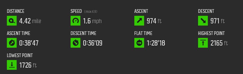
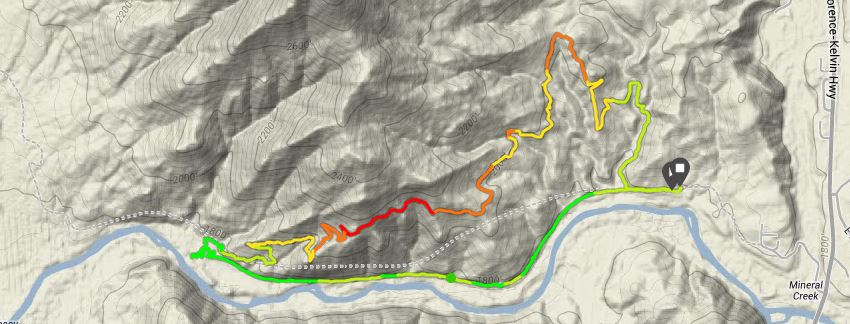
Today a small group of us, just 7 hikers, took a fun little hike on one of the newer sections of the Arizona Trail near the town of Kelvin out in copper country south of Superior. The three frames below give the “details” as recorded by my track pod.

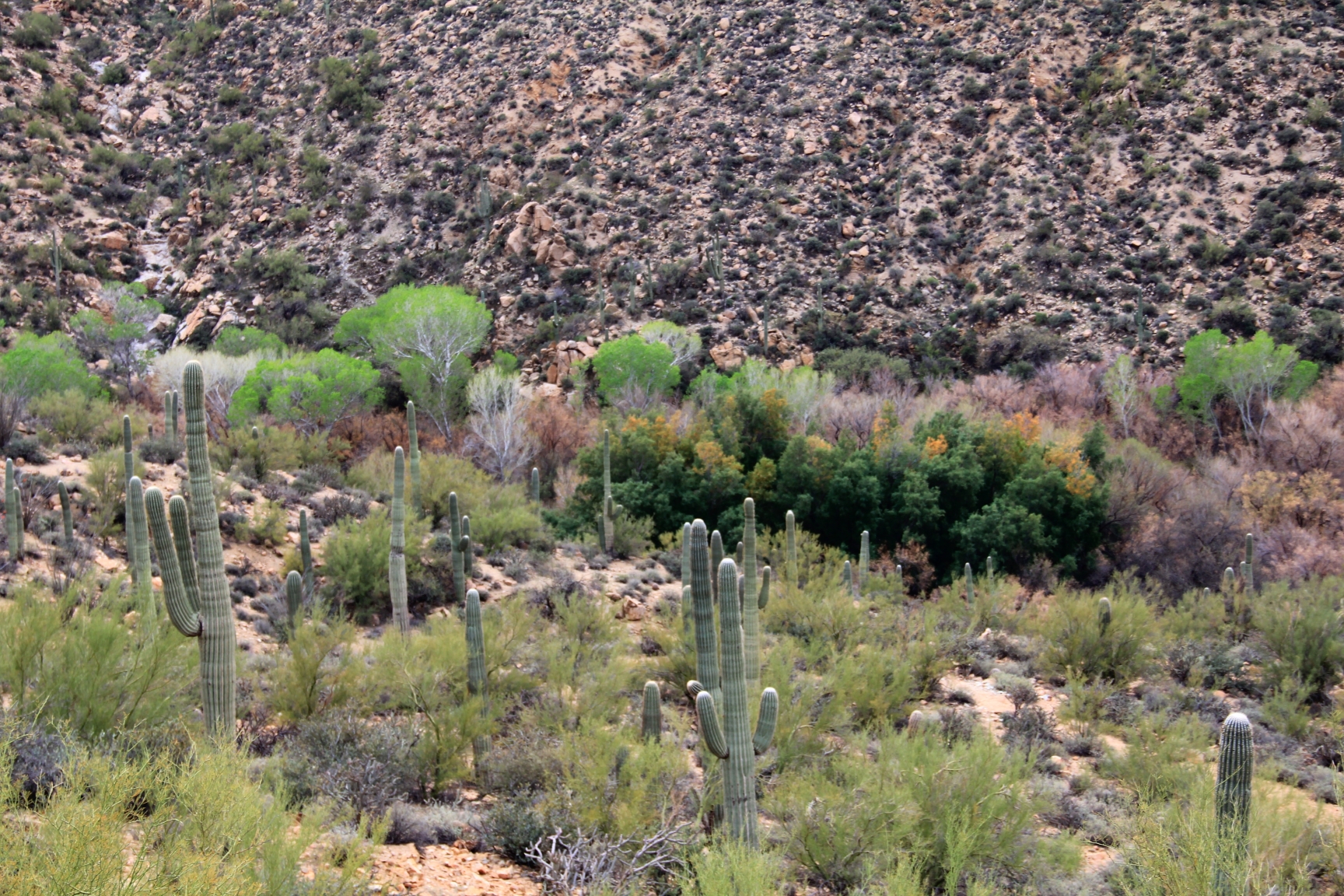
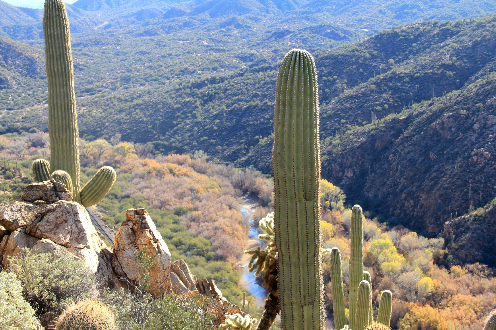
The first two miles of this trip was an excellent trail, built by the Arizona Trails Association, which climbs on a rolling route above the Gila River which has a fairly decent flow of water at this point.

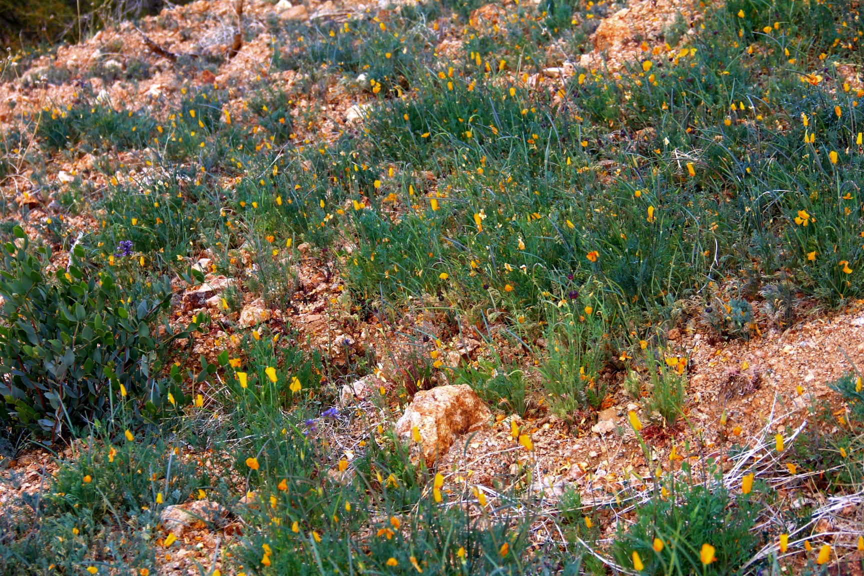
The spring flower bloom has started in these hills, and it’s great to see the color returning. This hillside of Mexican poppies will be golden with a blue counterpoint of lupine in a week or so.
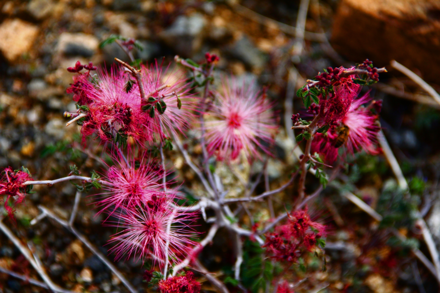
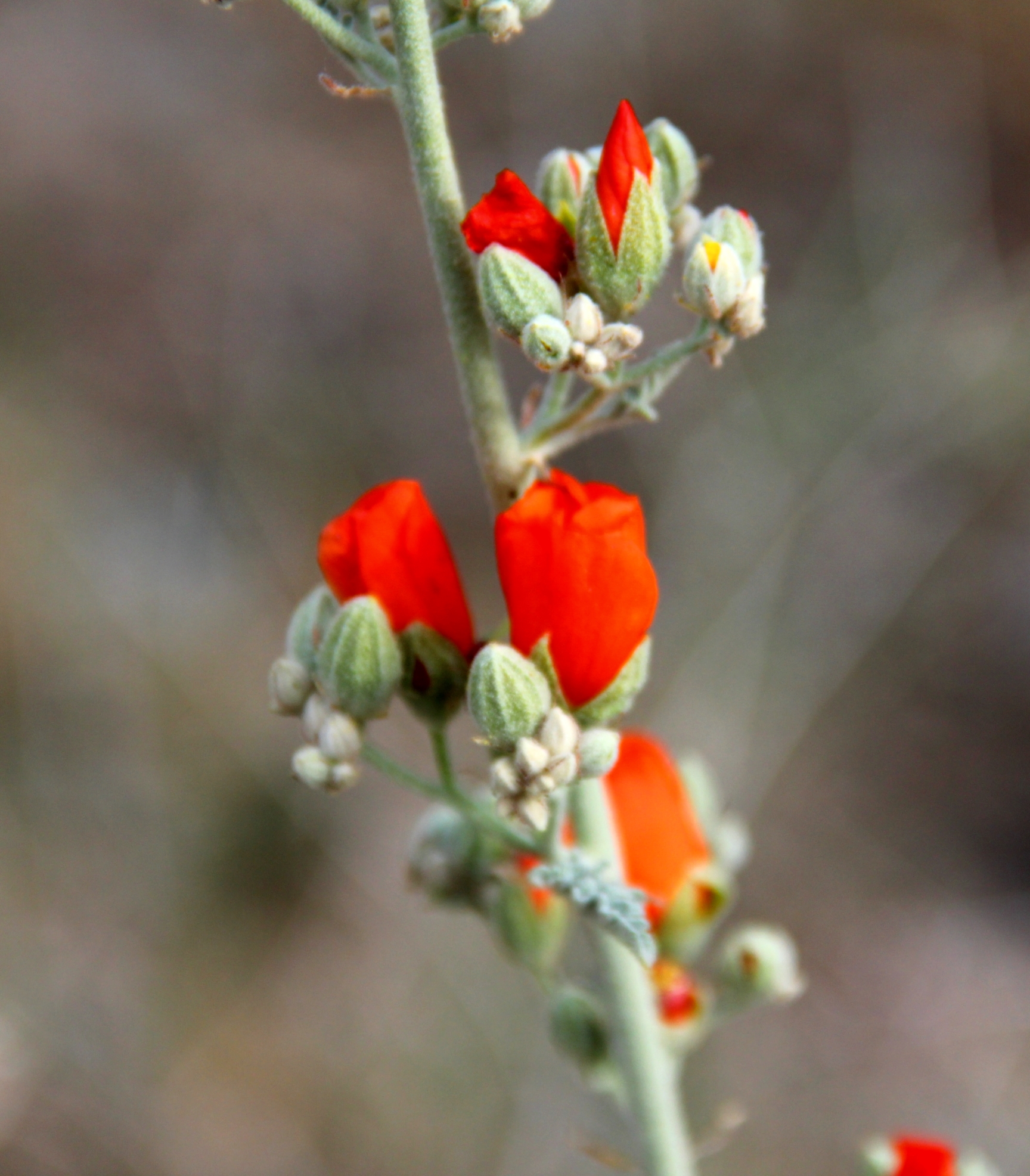
Here are some more examples of the variety of flowers which we enjoy every spring.


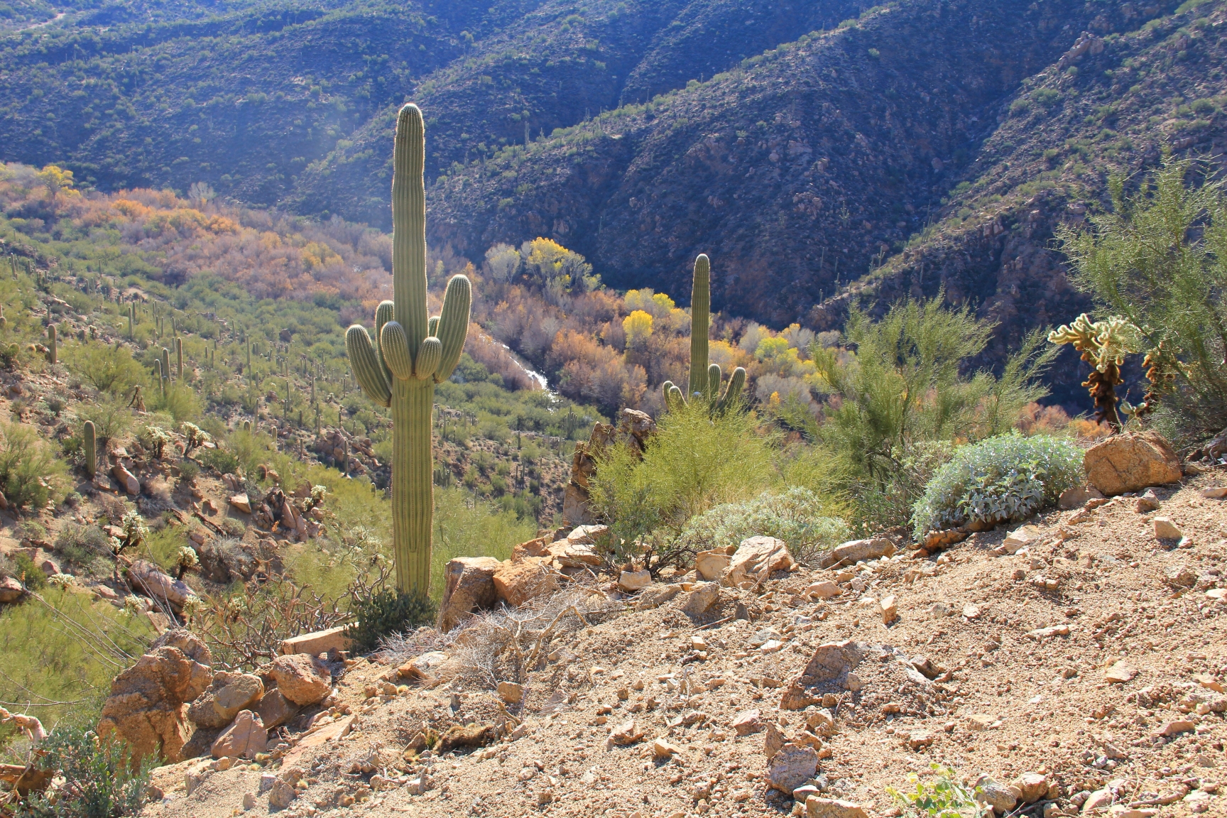
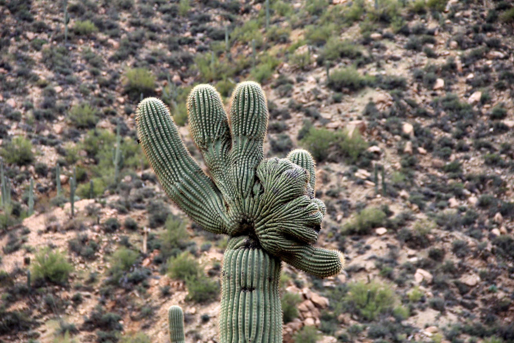
At about the 2 mile point the trail starts a descent down to the river, surrendering all the elevation we had gained. On the downslope there were a couple examples of crested saguaro. This one was close enough to the trail to get a nice look at the mutation.
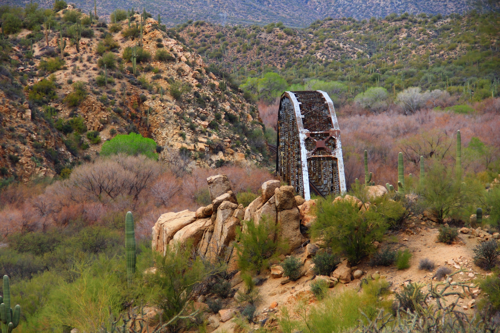
 The descent into the river valley brings us to this picturesque old railroad bridge. It still serves an active railway which serves the coppermines to the east of us. We at our lunch near this bridge.
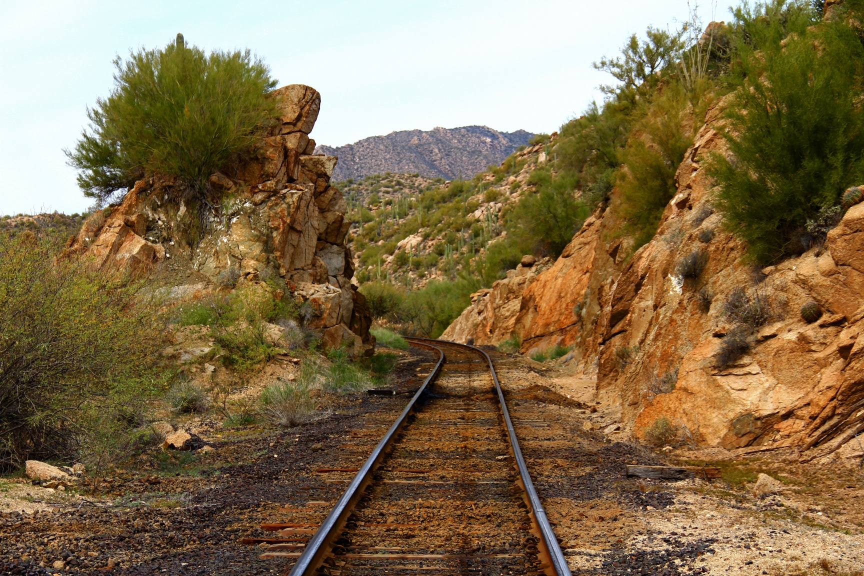
I guess we were a bit lazy today, so rather than return via our inbound route up in the higher country we ambled back to the trailhead area over the flat railroad bed.
All in all, not a dramatic trek, but it was a fun and scenic break from some of the more aggressive routes I’ve hiked lately.

love the flower photos
LikeLike
Nice! Surprised at all the flowers considering how dry it is.
LikeLike
great pics, Hans – looks like a nice gentle hike, and a pretty one – sorry I missed it – like the flower pictures
LikeLike