

(Before I describe the hike, I need to give a caution about the road up to the trailhead. FR201 is an 8-mile very narrow and twisty mountain road which in dry weather is easily passable with a typical short-wheelbase SUV. It is NOT SUITABLE for a long wheelbase pickup, or a “dually”. REGARDLESS OF YOUR VEHICLE, DO NOT attempt this road after a rain or snow storm. Once you commit to the drive there are very few points where you can bail out and turn around, and if slippery any spin out would almost certainly lead to loss of your vehicle.)
Having said all of that, the road is generally well maintained, has a smooth surface, and will not be a problem in dry weather. Your passengers (driver, you keep YOUR eyes on the road) will enjoy breathtaking views at every turn. The trip up this road is visually stunning.
This hike has been on my bucket list for two years now, ever since George, Peter, and I scouted both ends of it back in the spring of 2012.
Yesterday 6 of us (Tony, Mark, George, Ken, Peter, and I) hiked the Arizona Trail “Passage 22” from Peeley Mountain to the trailhead at Cross F Ranch. This 12 mile route takes you over connecting segments of several trails in the Mazatzal mountains (#86, #95, #88, #91, and #244).
We don’t know what happened to this guy, but not all junctions are well marked, and some sections of the trails are pretty sketchy, so this is a “pay attention to your map” hike.

Here are the particulars of the route as recorded by my Suunto GPS Track Pod.

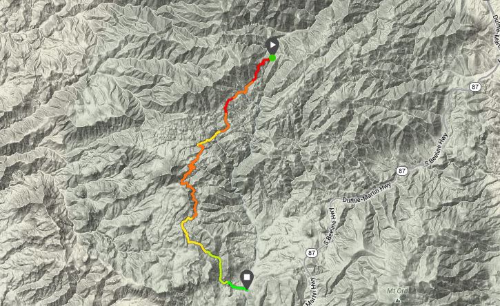
(You can see a larger version of the map above and an interactive version of the elevation charge below at http://www.movescount.com/moves/move26710694)

I’d classify this hike as strenuous, primarily because of the length. As you can see, overall this is a downhill hike. While there is a fair amount of elevation gain it is early in the hike when your legs are fresh, and is distributed between downhill or flat segments so you have a chance to rest your legs. Pace yourself and carry a good supply of water.
The hike starts at about 5,600 feet altitude and is above 4,000 for almost the entire route, so this is a candidate for a spring day when it is too warm to hike down here in the valley.
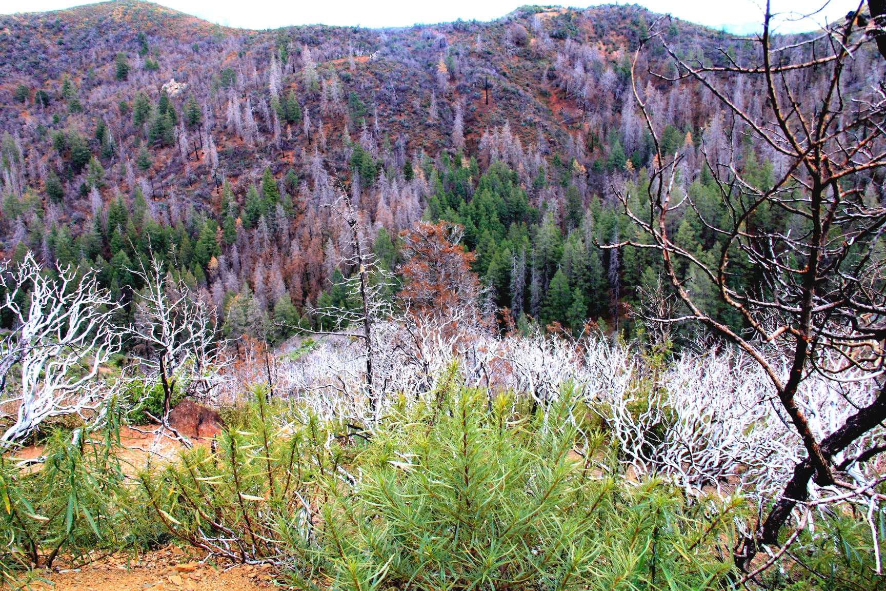
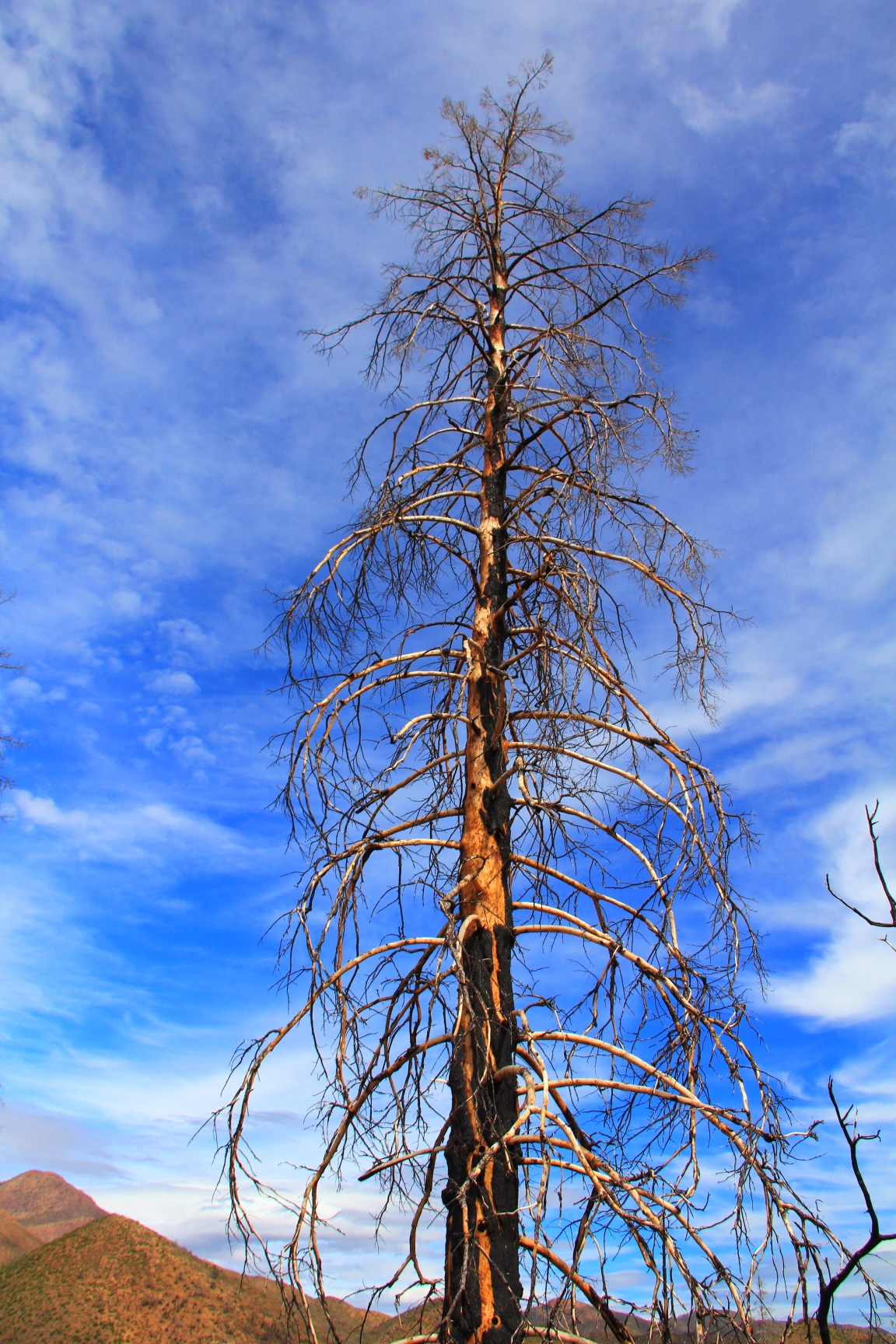
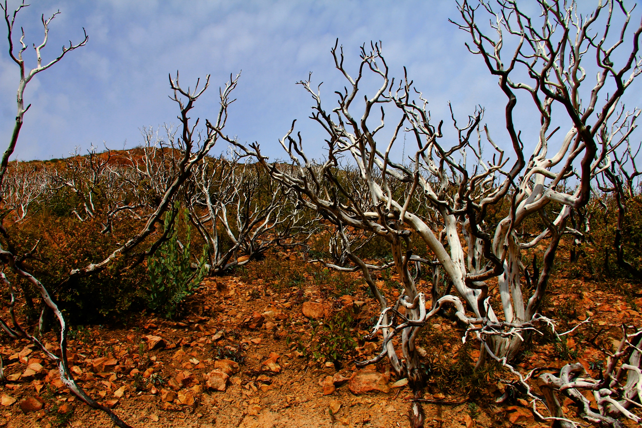
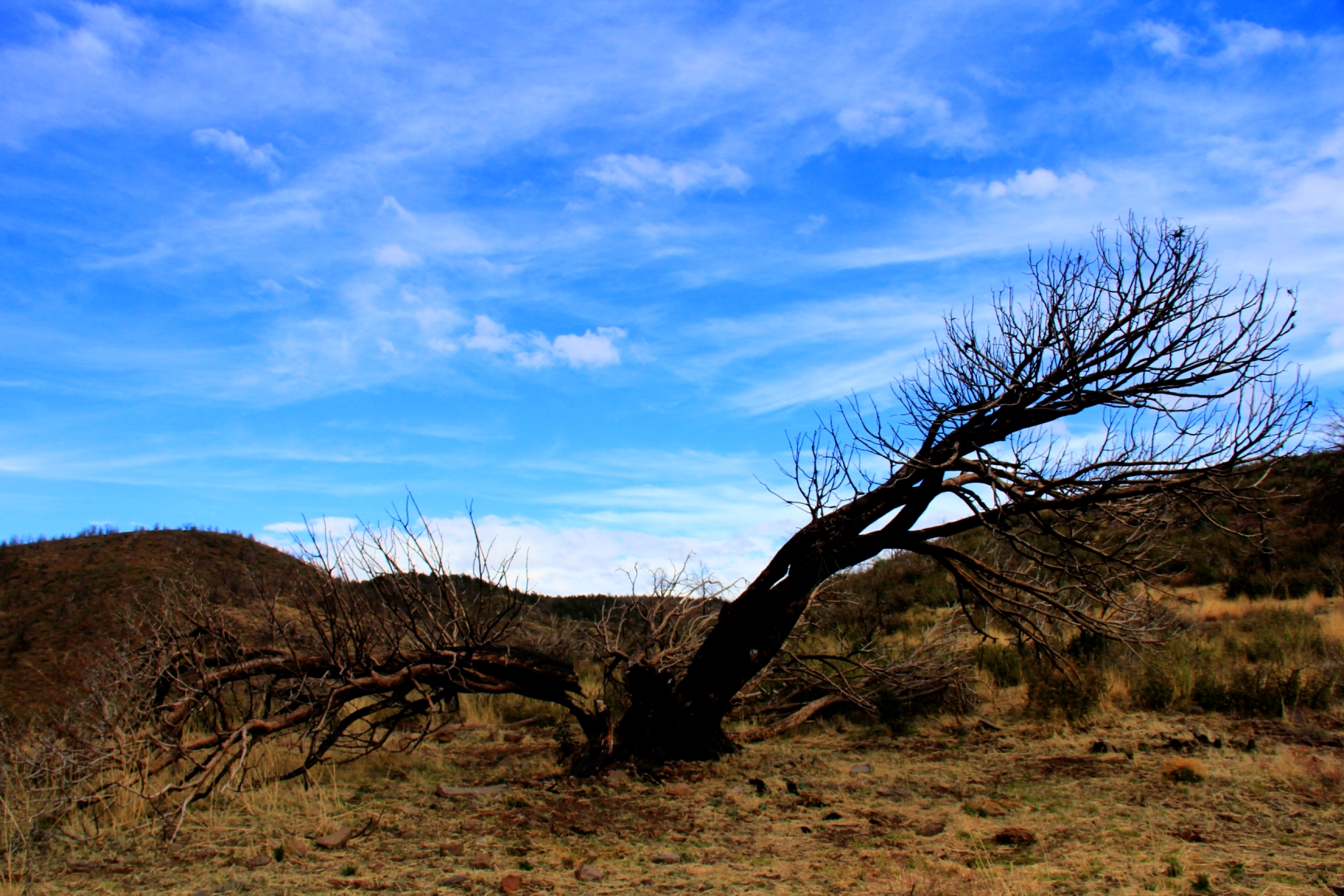
This is a visually interesting hike, but not “pretty” in the traditional sense. Most of this area has been involved in the “Sunflower Fire” of 2012 and the “Willow Fire” of 2004. Smokey the Bear wouldn’t like this place!
The dominate “vegetation” all along the route are the reminders of those fires.

Sometimes mountainsides are a mottled mix of dead and live Ponderosas. The stark white skeletons in the foreground are the bleached remains of Mountain Holly.


Speaking of burned out old timber, here is a view of three specimens who hiked with me. (Tony and Mark forged way ahead of us out of camera range.) Left to right, “Lonesome George” (who did the Lewis and Clark work for this trek), “Bandana Pete”, and “Cactus Butt Ken” (ask him).

Not all the scenery is so bleak, however.
A lot of the hike is on high ridgelines, so broad vistas are commonplace. All of the prominent landmark features in a 50-mile radius, like Mount Ord, Weavers Needle, 5057, Flatiron, Four Peaks, the Mogollon Rim, and others were visible at one time or another.


This was a fun hike with a small group. Other than my 5 companions, no other human was seen all day, and the solitude was the kind to put you into a contemplative mood as the miles passed away under your boots. For example, you could wonder “why would a fella leave a perfectly good hiking cap lying on top of a trail-marking cairn way out here in the wilderness.

Or “why is there a rock inside this bigger rock and how the heck did it get there?”


Looks like a beautiful hike, Hans. You showed again how even dead or burned vegetation can be very picturesque!! Gorgeous pics again – thanks for sharing them.
LikeLike
I always look forward to seeing your pictures! Thanks for the description of the trail!
LikeLike